
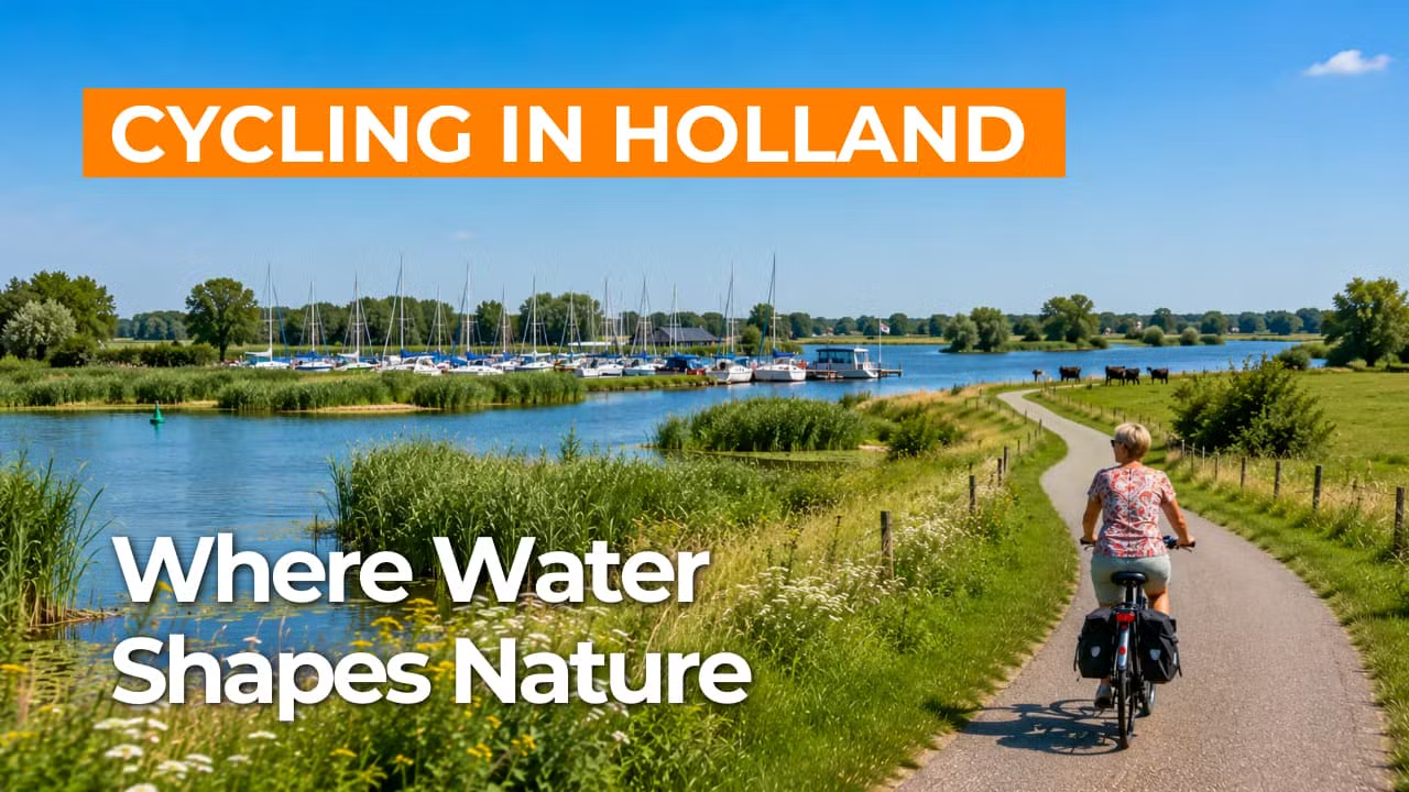
Cycling route Riverpark Maasvallei and Maasplassen
Cycling through lush river nature, a white town and the largest continuous water sports area in the Netherlands.
The Landscape
Riverpark Maasvallei is a dynamic river landscape along the winding Maas, where water and nature continually reshape the scenery. You cycle past wide river branches, floodplains and flower-rich grazing areas, edged by rough woodlands and quiet dike paths. Former meanders and historic dikes reveal how people and river have shaped this landscape together for centuries.
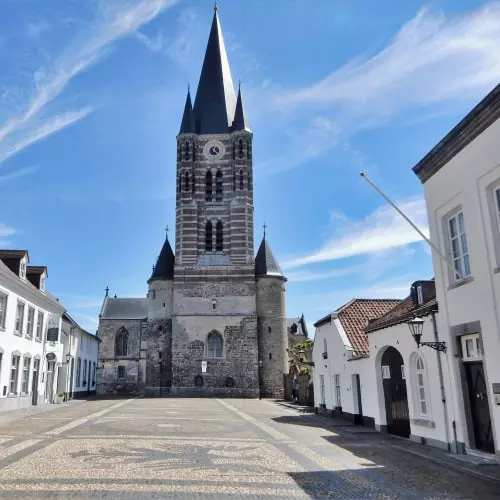
Between the bends of the river lies Thorn, the White Town, with cobbled streets of Maas pebbles, intimate alleys and distinctive facades that seem to glow in the sunlight. The Maasplassen add a second dimension: an extensive network of lakes formed by gravel extraction, now known as the largest water sports area in the Netherlands. Around the clear waters, reed beds, small beaches, islands and sheltered nature reserves alternate, so the route continually shifts between tranquillity, open space and a strong sense of water.
What You’ll Discover Along the Way
Along the Maasvallei, riparian forests, scrub and sheltered spots by the dike alternate, so each stretch brings a new setting. On the slightly higher sandy edges, remnants of heath and open fields appear, offering wide views across the river landscape. This gives the route a blend of greenery, rugged character and a light, open feel.
In Thorn, you cycle through narrow streets paved with Maas pebbles, past white facades and historic buildings, with the Abbey Church as a refined focal point. A little further on, Kasteel Horn highlights the region’s close connection to the Maas, standing as a sturdy ring castle beside an old river bend. Dikes, village centres and historic landscape patterns add a clear sense of depth and character throughout the route.
The Maasplassen form an extensive water landscape of large and small lakes, created by gravel extraction and now known as the Netherlands’ premier water sports area. Around the clear waters, recreational beaches, reed zones and green islands give the route a true holiday feel. In many places, you cycle with open views across the water, where birds and passing boats define the scene.
The Maas is the guiding thread of this cycling route, with broad river branches, floodplains and former meanders opening up new views at every turn. You ride along dikes and past natural grazing areas where the river has room to flow and the landscape remains in motion. Small waterways and wet margins link the river to the lakes, so the presence of water is never far away.
Ride along with us on this virtual bike tour
Virtual cycling through Riverpark Maasvallei and the Maasplassen takes you along the winding Maas, past floodplains, flower-rich grazing areas and quiet dike paths with wide river views. Along the way, rugged nature and open vistas alternate, creating the sense of moving through the landscape with the flow of the water.
In this virtual cycling route, you also discover the White Town of Thorn and the expansive lake area of the Maasplassen, where reed-lined shores, small islands and recreational waters create a true holiday atmosphere. Ideal for a relaxed indoor ride from home, with ever-changing views over river and water landscapes.
Want to learn more about virtual cycling? THIS IS HOW VIRTUAL CYCLING WORKS
Route map and cycling junctions
Start and finish at cycling junction 95 on the Raadhuisplein in Horn. Because this is a circular route, you can also start at one of the other cycling junctions along the route.
Distance: 48 km
Estimated riding time: 3 hours 13 minutes
Elevation gain: 154 m
Paved roads: 90%
Unpaved / semi-paved: 10%
Ideal for: e-bikes and city bikes
Along the way: several options for a coffee break or lunch.


