
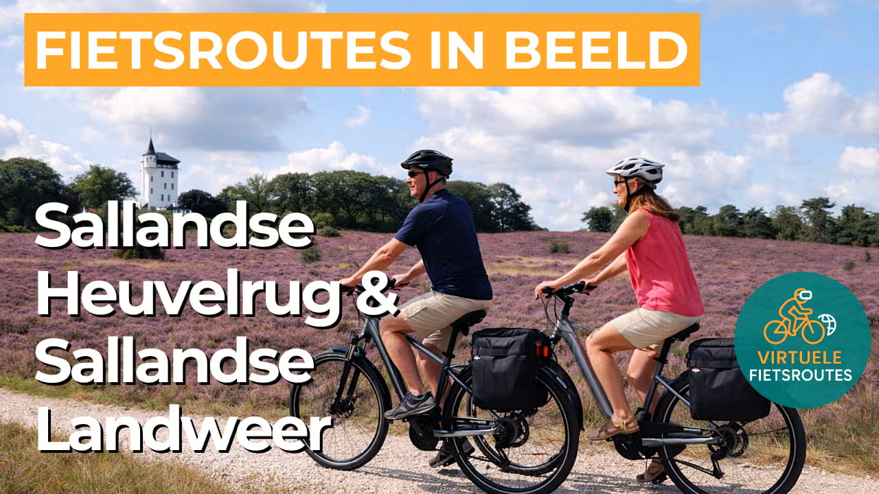
Cycling route Sallandse Heuvelrug and Sallandse Landweer
Cycling through a varied landscape of rolling heathlands, forested hills, scenic country estates, fertile farmlands, and gently flowing streams.
The Landscape
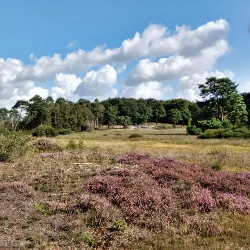
The Sallandse Heuvelrug is one of the most impressive glacial ridges in the Netherlands and surprises visitors with rolling hills, quiet forests, and heathlands that belong to the largest continuous areas of dry heath in Northwestern Europe. The landscape was shaped during the Ice Age, when glaciers pushed up the terrain, while meltwater and wind further sculpted it. As a result, you now cycle past deep valleys, sandy ridges, and sweeping views that constantly change in character.
From the foot of the ridge towards Deventer runs the Sallandse Landweer, a medieval defensive line whose embankments, ditches, and ingenious waterworks still leave visible traces across the landscape today. Here, the route gradually shifts into the Salland bocage landscape, with hedgerows, historic farmyards, characteristic farms, and country estates that give the countryside its rhythm and charm, while streams and waterways add tranquillity, greenery, and an almost effortless sense of serenity.
What You’ll Discover Along the Way
Around Holten, you cycle through pine forests and across open heathlands where space and silence set the tone, with ever changing views towards the higher heath covered ridges. In the transition from forest edge to heath, you can sense how the glacial ridge landscape shapes the light and contours, allowing sweeping panoramas to emerge almost naturally.
This cycling route follows the traces of the Sallandse Landweer and lets you experience how defence, agriculture, and settlement together shaped the landscape for centuries. Along the way, historic farmyards, traditional landscape features, and estate like surroundings appear throughout the route, allowing cultural history and the greenery of Salland to blend together effortlessly.
In the Salland countryside, streams and waterways shape the open farmland with green banks and calm ribbons of water that give structure to the landscape. The Schipbeek and the Dortherbeek fit seamlessly into the story of the landweer, as water here is not only part of nature, but also an element of an ancient defensive system.
The Sallandse Heuvelrug creates clear elevation changes, with short climbs and smooth descents that keep the route lively without becoming too demanding. On the higher sections, the heath covered ridges lie roughly between 45 and 70 metres above sea level, while the Grote Koningsbelt forms the distinctive highest point that highlights the character of this glacial ridge landscape.
Ride along with us on this virtual bike tour
Virtual cycling through the Sallandse Heuvelrug and the Sallandse Landweer takes you through one of the most varied cycling landscapes in Overijssel, with rolling heathlands, quiet pine forests, and surprising elevation changes around Holten and the heath covered ridges. You experience the route as if you were cycling there yourself, surrounded by tranquillity, open space, and ever changing views that alternate between open heath and sheltered forest edges.
Afterwards, the virtual cycling adventure gradually enters the Salland bocage landscape, where hedgerows, farmhouses, and estate lanes follow the line of the Sallandse Landweer and make history almost tangible. Along the way, streams and waterways such as the Schipbeek and the Dortherbeek shape the countryside, allowing nature, heritage, and water to come together in a distinctly Salland story.
Want to learn more about virtual cycling? THIS IS HOW VIRTUAL CYCLING WORKS
Route map and cycling junctions
Start and finish near cycling junction 71 on the Stationsstraat in Holten. Because this is a circular route, you can also start at one of the other cycling junctions along the route.
Distance: 58 km
Estimated riding time: 3 hours 53 minutes
Elevation gain: 99 m
Paved roads: 75%
Unpaved / semi-paved: 25%
Ideal for: e-bikes and city bikes
Along the way: several options for a coffee break or lunch.


