
Cycling route National Landscape Laag Holland and Waterland
Cycling through a water-rich polder landscape with traditional Dutch villages, reed-lined shores and wide views across the Markermeer.

The Landscape
In National Landscape Laag Holland, you cycle through a setting of green polders, shimmering waterways and windmills that have regulated the water for centuries. Between the dikes lie villages and hamlets with wooden houses and characteristic farmyards, giving the landscape its distinctive, tranquil Dutch character.
Waterland is a low-lying peat landscape where land and water lie close together, divided by narrow dikes, canals and historic bridges. Along reed beds and wet grasslands, quiet nature areas are filled with birdlife, while the open horizon offers far-reaching views of water, sky and distant church towers.
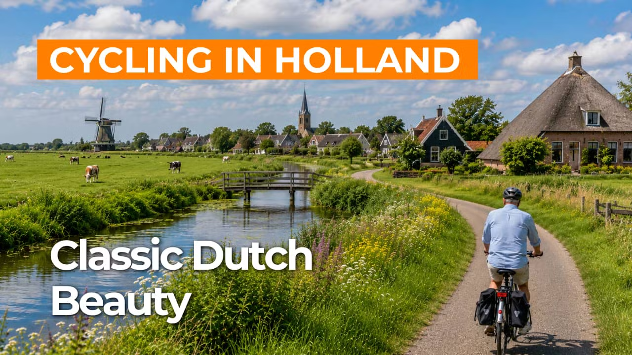
What You’ll Discover Along the Way
Around Marken, you see how dikes, sluices and waterworks have shaped life along the former Zuiderzee. Wooden houses, the historic dike village and navigation markers along the water give this route a distinct historical character that remains visible throughout the ride.
In Laag Holland and Waterland, the polders unfold like open rooms behind low dikes, with grasslands, grazing cattle and waterways dividing the land into long strips. You cycle along quiet polder roads past farmhouses and small bridges, while the peat meadow pattern of fields and ditches creates an open horizon and classic Old Dutch views.
In Laag Holland and Waterland, the polders unfold like open rooms behind low dikes, with grasslands, grazing cattle and waterways dividing the land into long strips. You cycle along quiet polder roads past farmhouses and small bridges, while the peat meadow pattern of fields and ditches creates an open horizon and classic Old Dutch views.
The Markermeer and the Gouwzee shape the character of the route with expansive water views that appear time and again. On clear days, dikes and village edges trace thin lines along the horizon, making the waterscape feel even more open and light.
Ride along with us on this virtual bike tour
Virtual cycling through National Landscape Laag Holland and Waterland lets you experience a classic Old Dutch setting of expansive polders, narrow dikes and waterways that reflect the sky across the peat meadow landscape. On screen, quiet country roads, small bridges and reed-lined shores pass by at an easy pace, with wide views that continually open up.
Along the way, characteristic villages come into view, with Marken as a standout highlight by the water, where wooden houses and the dike edge reflect a long history of land reclamation and water management. With the Markermeer and the Gouwzee in sight, every kilometre feels open and light, as if you are riding along the dike yourself.
Want to learn more about virtual cycling? THIS IS HOW VIRTUAL CYCLING WORKS
Route map and cycling junctions
Start and finish at cycling junction 99 on the Haven in Volendam. Because this is a circular route, you can also start at one of the other cycling junctions along the route.
Distance: 60 km
Estimated riding time: 4 hours 5 minutes
Elevation gain: 39 m
Paved roads: 99%
Unpaved / semi-paved: 1%
Ideal for: e-bikes and city bikes
Along the way: several options for a coffee break or lunch.


