
Cycling route National Landscape Zuidwest Fryslân
Cycle through an open, expansive landscape of ditches, lakes, dikes, reed beds, peat meadows, fields and historic harbor towns.

The Landscape
National Landscape Zuidwest Fryslân is a broad mosaic of water, nature and cultural heritage, shaped by centuries of living with the sea, lakes and peat. Terps, dikes and historic land reclamation tell the story of protection, land creation and smart water management. Within a single region, open clay meadows, water-rich peatlands and lakes, the rolling landscape of Gaasterland and the expansive IJsselmeer coast alternate seamlessly.
Along this route, you mainly experience the peat and lake district, the clay landscape and the coastal zone. In the peatlands, canals, ditches and lakes form an intricate network, with reed fringes and flower-rich grasslands creating a calm, natural setting. The clay areas feel more structured and spacious, with dikes, straight plots and fertile fields that have supported Frisian agriculture for centuries. Along the IJsselmeer coast, the presence of water comes close, as outer-dike margins and bird-rich areas create a striking contrast with the open polders, while Hindeloopen, Workum and Stavoren add atmosphere and history along the way.
What You’ll Discover Along the Way
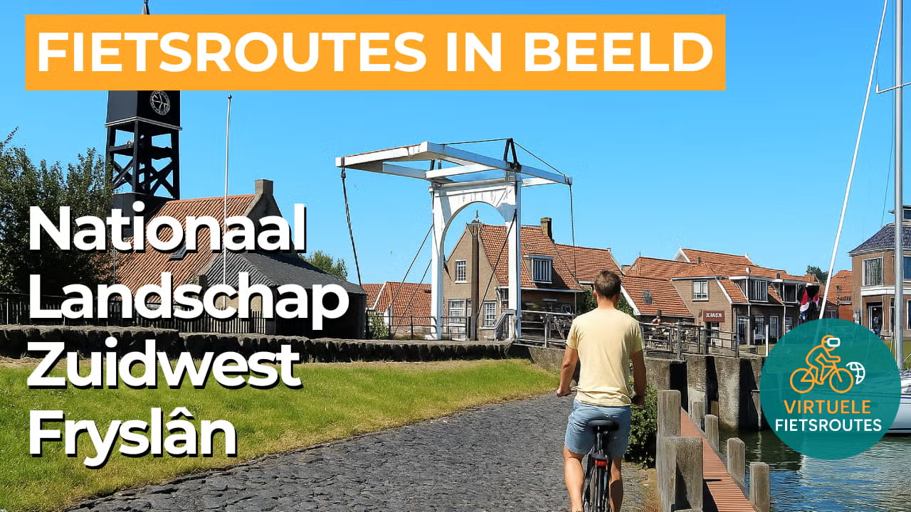
Around Hindeloopen, you cycle through a region where cultural history remains clearly visible in village ribbons, historic routes and characterful harbor towns. Hindeloopen is a nationally protected townscape, reflected in its compact historic setting and distinctive waterfront atmosphere. Toward Gaasterland, country estates, forest avenues and gently rolling terrain add extra variety to the route.
The route follows the IJsselmeer coast along the former Zuiderzee line, where dikes and waterworks clearly define the landscape. You ride with wide views over the water, passing charming harbor towns such as Hindeloopen, Workum and Stavoren. Beyond the dikes, sandbanks, mudflats and green cliffs create a more rugged, bird-rich coastline, giving the scenery a constantly changing character.
In the terp and clay region, clear traces of the Middle Ages remain visible, with terps and winding dikes that once protected the land from the sea. It has long been a fertile agricultural area where open space dominates, with historic towns such as Hindeloopen and Workum standing out as landmarks in the landscape. Cycling between ditches and neatly laid-out fields, you experience the characteristic blend of openness, history and structured land patterns.
In the peat and lake district, water is always close at hand, with lakes, canals and shorelines giving the landscape a calm, flowing rhythm. Reed fringes, wet grasslands and open water create a strong sense of space and ever-changing views. Along the way, you pass waterside villages and quiet banks, making this an ideal route for a relaxed ride with a true Frisian water experience.
Join our virtual bike tour and experience the journey
Virtual cycling through National Landscape Zuidwest Fryslân lets you experience the Frisian water landscape from home, with peat meadows, reed fringes, canals and lakes setting the rhythm. In the video, you ride through an open landscape of dikes and long sightlines, ideal for steady training on your indoor trainer.
Towards the IJsselmeer coast, wide views open up alongside the atmosphere of harbor towns such as Hindeloopen, Workum and Stavoren. The contrast between orderly polders and outer-dike landscapes keeps the route varied, giving you a true outdoor feeling from the comfort of home.
Want to learn more about virtual cycling? THIS IS HOW VIRTUAL CYCLING WORKS
Route map and cycling junctions
Start and finish near cycling junction 96 on Madenlaan in Hindeloopen. Because this is a circular route, you can also start at one of the other cycling junctions along the route.
Distance: 58 km
Estimated riding time: 3 hours 53 minutes
Elevation gain: 31 m
Paved roads: 100%
Ideal for: e-bikes and city bikes
Along the way: several options for a coffee break or lunch.


