Castle Valley and Utrechtse Heuvelrug
Cycling in a historical landscape with hills, forests, heathlands, fields, meadows, orchards, mansions, avenues, floodplains, and rivers.

The Landscape
In the centuries-old cultural landscape north of the Lower Rhine, two worlds meet: the low, water-rich river plains and the high, sandy ridges of the Utrechtse Heuvelrug. This natural ridge was formed around 150,000 years ago during the penultimate Ice Age. For centuries, the area has been celebrated for its varied nature and historic scenery, where wealthy families once built their castles and country estates. Today, the Utrechtse Heuvelrug is a place where nature and culture come together in a gently rolling landscape of dense forests, purple heathlands, drifting sand plains, and stately historic estates.
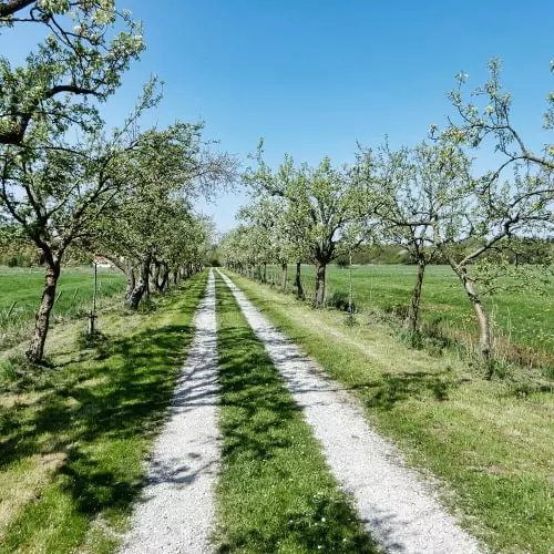
Between the floodplains of the Lower Rhine and the wooded hills of the Utrechtse Heuvelrug lies a picturesque valley dotted with stately castles, historic estates, lush country houses, and orchards bursting with fruit trees. This transition zone is one of the most beautiful and diverse regions in the Netherlands, where the layers of history can still be read in the landscape. Pollard willows line the meadows, coppice woods alternate with wet hayfields, while higher up, expansive forests, heathlands, and drifting sand dunes shape the scenery. The striking contrasts between low and high, wet and dry, farmland and wilderness make this area truly unique and a place where nature and history go hand in hand.

Forests and Heaths

Estates and Heritage

Rivers and Streams

Hills and Valleys
Route map
Start and finish at bike node 15 on the Singel in Wijk bij Duurstede. However, this bike route is a circular tour, so it offers the possibility to start from any of the following bike nodes.
🕀 - 🕀 - 15 - 14 - 13 - 95 - 27 - 9 - 61 - 25 - 23 - 59 - 72 - 5 - 49 - 4 - 16 - 24 - 3 - 6 - 43 - 7 - 70 - 8 - 10 - 21 - 91 - 86 - 🕀
- 91% of the route runs on paved roads.
- 9% of the route runs on unpaved and semi-paved paths.


