
Cycling route Hollands Kroon and Wieringen
Cycle through a landscape of open polders, abundant water, dikes, reed beds, fields, meadows, polder woodlands and a former island.

The Landscape
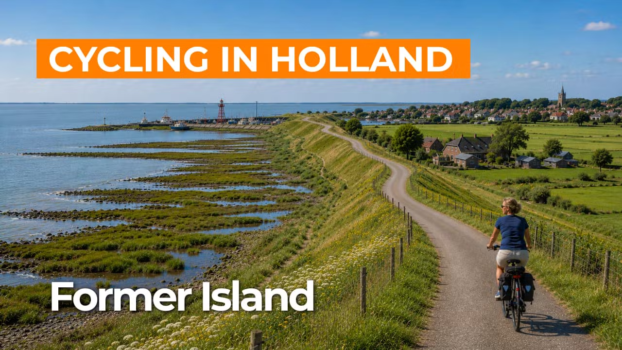
Wieringen was an island for centuries and was only connected to North Holland in 1924, yet the island feeling remains unmistakable. Surrounded by water, with vast skies and long views towards the Kop van Noord Holland and Texel, every dike feels like a natural boundary of the landscape. You cycle over gentle undulations and higher ridges, following winding roads that naturally weave through the old land and reveal ever-changing views of the water. In the salty sea breeze, this area offers a distinctly different North Holland landscape compared to the flat, structured polders that surround it.
In Hollands Kroon, you cycle through a vast polder landscape where space, straight lines and wide-open views take center stage. Large fields and meadows lie in neatly arranged plots, intersected by perfectly straight ditches and broad canals, with quiet polder roads following the geometric layout. In spring, colorful bulb fields add vibrant stripes that make the scenery especially photogenic. Around farmsteads, reed fringes, shelterbelts and small woodlands provide pockets of cover, creating a dynamic balance between openness and greenery, making Hollands Kroon a striking contrast to Wieringen with the same fresh air and sense of freedom, yet a distinctly North Holland polder character.
What You’ll Discover Along the Way
In Hollands Kroon and on Wieringen, polder woodlands, shelterbelts and reed fringes create sheltered stretches between the open fields. This contrast makes for an enjoyable ride, as wide views suddenly give way to green, protected lanes. On the higher parts of Wieringen, the landscape feels slightly more rugged and surprisingly varied, with gentle elevation changes and winding roads.
Along the dikes, you experience the salty character of the Wadden coast, with sweeping views over water, sky and an endless horizon. Near Den Oever, you reach the Afsluitdijk and see how important water engineering is in this area. On clear days, the Wadden Sea and the IJsselmeer appear side by side as two distinctly different worlds.
You cycle through a spacious, structured polder landscape where fields, meadows and straight ditches set the pace. The scenery feels vast and calm, with long lines of dikes and canals naturally guiding you forward. Farmhouses and farmsteads stand as landmarks in the open land, often lined with rows of trees that offer shelter from the wind.
The Amstelmeer introduces open water and reedlands to the route, creating a fresh, almost coastal atmosphere. Along its edges, small dikes, inlets and wet grasslands alternate, inviting you to slow down and take in the surroundings. Further along, ditches, canals and wide waterways remain ever-present as shimmering lines through the polder landscape.
Join our virtual bike tour and experience the journey
Virtual cycling through Hollands Kroon and Wieringen takes you across vast polders with neatly laid-out fields, straight canals and far-reaching views that are typical of North Holland, where fields and meadows unfold in broad expanses and the constant presence of water and wind shapes the landscape.
On Wieringen, the island character is still clearly felt, with gentle undulations, winding roads and views over the Wadden Sea and the IJsselmeer. The salty air, surrounding dikes and the setting of Den Oever and the Afsluitdijk make this virtual cycling route especially varied and memorable.
Want to learn more about virtual cycling? THIS IS HOW VIRTUAL CYCLING WORKS
Route map and cycling junctions
Start and finish near cycling junction 55 on the Akkerweg in Den Oever. Because this is a circular route, you can also start at one of the other cycling junctions along the route.
Distance: 49 km
Estimated riding time: 3 hours 17 minutes
Elevation gain: 83 m
Paved roads: 98%
Unpaved / semi-paved: 2%
Ideal for: e-bikes and city bikes
Along the way: several options for a coffee break or lunch.


