
Cycling route Norger Esdorp Landscape and Fochteloërveen
Cycle through a largely untouched raised bog landscape with wide-open views, quiet heathland, ancient forests, and the monumental heritage of the former prison village of Veenhuizen.

The Landscape
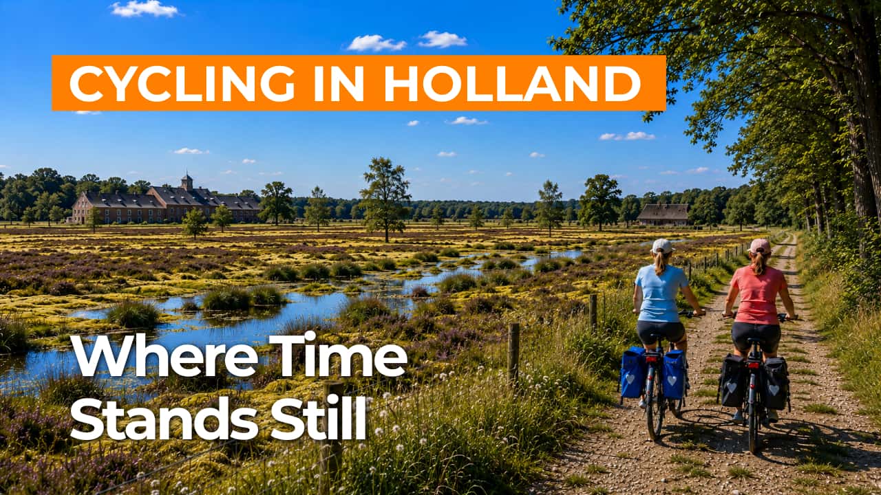
The Norger esdorp landscape in North Drenthe is one of the best-preserved cultural landscapes in the Netherlands. You cycle through a small-scale mosaic of raised fields on sandy ridges, hedgerows, sandy tracks, and green lanes that give the brink villages around Norg their distinctive character. Open arable fields gradually transition into sheltered stream valleys, with wet grasslands, small marshes, and alder carr woodlands gently descending towards the lower ground.
The scenery then opens towards the Fochteloërveen, on the border of Drenthe and Friesland. This is one of the last extensive raised bog landscapes in Western Europe, with peat plains, bog hollows, peat cuttings, and straight dikes that still reflect its peat-cutting past. In the quiet of the bog, you mainly experience space, light, and a horizon that seems endless. To the north lies Veenhuizen, a former colony and prison village where the heritage of the Colonies of Benevolence has been a UNESCO World Heritage Site since 2021, clearly visible in its orderly avenues and monumental buildings.
What You’ll Discover Along the Way
Around Norg and Veenhuizen, sheltered forest paths alternate with open heathland, creating a route that continually shifts in atmosphere while maintaining a calm, unhurried feel.
Veenhuizen adds a distinctive cultural-historical dimension to this cycling route, with straight avenues, stately buildings, and a village layout unlike anywhere else in the Netherlands.
Between the nature areas, you ride through open farmland with long sightlines, fields, and meadows that create a spacious and relaxed cycling experience.
In the Fochteloërveen, you cycle through an open, wet landscape where peat, water, and sky shape the scenery, and the quiet naturally slows your pace.
Ride along with us on this virtual bike tour
Virtually cycling through the Norger esdorp landscape lets you experience the character of North Drenthe from home, with small-scale brink villages, historic fields, hedgerows, and quiet lanes. You ride through a varied patchwork of farmland, sandy tracks, and sheltered green corridors.
In the Fochteloërveen, wide-open views, wet bog hollows, and straight dikes from the peat-cutting past define the landscape, with a horizon that seems almost endless. Along the way, Veenhuizen adds distinct character with its monumental avenues and the heritage of the Colonies of Benevolence.
Want to learn more about virtual cycling? THIS IS HOW VIRTUAL CYCLING WORKS
Route map and cycling junctions
Start and finish near cycling junction 78 on the Laan Weldadigheid in Veenhuizen. Because this is a circular route, you can also start at one of the other cycling junctions along the route.
Distance: 56 km
Estimated riding time: 3 hours 44 minutes
Elevation gain: 38 m
Paved roads: 84%
Unpaved / semi-paved: 16%
Ideal for: e-bikes and city bikes
Along the way: several options for a coffee break or lunch.


