
Cycling route Ooijpolder and Millingerwaard
Cycling through a rugged river landscape of polders, oxbow lakes, bays, river dunes, flower-rich grasslands, rough vegetation and sandy river beaches.
The Landscape
The Ooijpolder and the Millingerwaard lie within National Landscape De Gelderse Poort, where the Waal continually reshapes the river landscape. In the Ooijpolder, you cycle through an open polder area of more than two thousand hectares, formed by centuries of flooding that left behind fertile layers of sand and clay. That same river power once brought disruption, with high water levels that changed lives and at times even swept away entire villages.
The Millingerwaard is one of the oldest nature restoration areas along the Waal and clearly shows how quickly a river landscape can recover. Where agriculture still dominated until the 1990s, there is now a living mosaic of floodplain forests, marshes, lakes and flower-rich grasslands. Konik horses and Galloway cattle roam the area, while beavers leave their traces along the water’s edge. Surrounding it is a high sandy natural levee that has developed into a distinctive river dune, offering beautiful views across the floodplains.
What You’ll Discover Along the Way
In the Ooijpolder, you cycle through wide-open polders with long sightlines along ditches, embankments and dike roads. Meadows and arable fields alternate, with scattered farmhouses adding rhythm to the landscape. The sense of space and tranquillity makes this part of the route around Millingen aan de Rijn especially relaxing.
Along the edge of the floodplains lie wet grasslands, reed beds and rough marsh zones where you can often see and hear many birds. Waterlogged areas and soft banks make it clear how closely water and land meet here. In the Millingerwaard, the scenery changes with the seasons, from fresh green meadows to golden-brown reed beds.
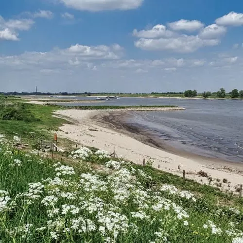
Along the route, oxbow lakes, inlets and quiet pools appear, formed from old river channels and breaches during high water. On calm days, clouds and reeds are reflected in the water, giving the area a tranquil atmosphere. These waters add variety and make the ride especially photogenic.
The Waal forms the common thread of the route, with dikes, channels and wide floodplains that seem to change shape constantly. From the higher dike sections, you look out over sandy banks and river plains where the light adds a strong sense of depth. It is precisely this dynamic interplay of water, wind and space that makes the Ooijpolder and Millingerwaard so distinctive.
Ride along with us on this virtual bike tour
Virtual cycling through the Ooijpolder and Millingerwaard takes you into a rugged river landscape in the Gelderse Poort, where the Waal winds past floodplains, dikes and open polders. From home, you experience wide panoramic views, green embankments and the rhythm of fields and meadows around Millingen aan de Rijn.
In the Millingerwaard, floodplain forests, marshes and quiet pools alternate, with river dunes and rough vegetation adding extra layers to the landscape. This creates a varied virtual cycling route full of water, nature and space, ideal for relaxing or riding along on your hometrainer.
Want to learn more about virtual cycling? THIS IS HOW VIRTUAL CYCLING WORKS
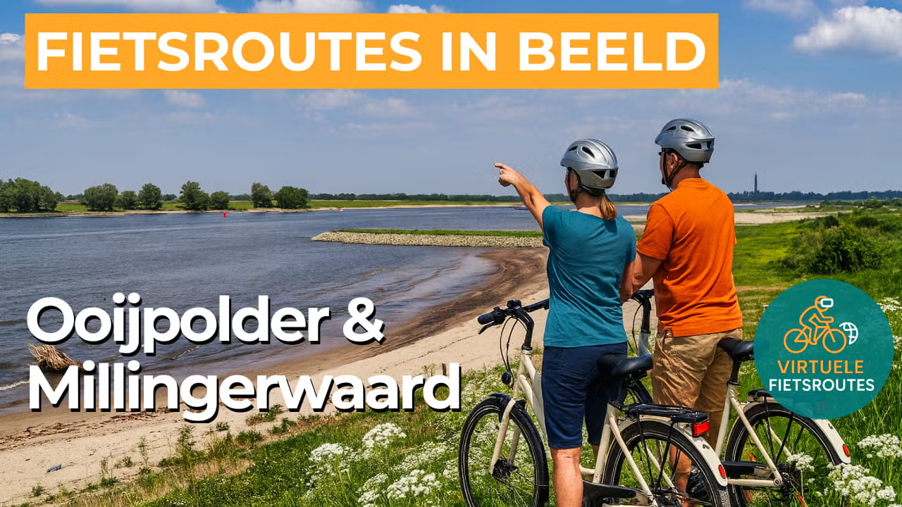
Route map and cycling junctions
Start and finish near cycling junction 66 at the Kerkdijk in Erlecom. Because this is a circular route, you can also start at one of the other cycling junctions along the route.
Distance: 47 km
Estimated riding time: 3 hours 8 minutes
Elevation gain: 92 m
Paved roads: 90%
Unpaved / semi-paved: 10%
Ideal for: e-bikes and city bikes
Along the way: several options for a coffee break or lunch.


