
Cycling route Goeree-Overflakkee and Duinen van Goeree
Cycling through a unique delta landscape of dunes, dikes, creeks, salt marshes and mudflats, where sea and land continue to shape one another.

The Landscape
Goeree-Overflakkee is an island of sun, wind and open space, where beaches and dunes merge seamlessly into dikes and polders. Everywhere you look, traces remain of centuries of living with water, from sturdy sea defences to quiet creeks that shape the land in delicate lines.
Along the southern side of the island, you cycle over winding dikes with views that continue to surprise. In the distance, the salt marshes and mudflats form a rugged mosaic, while towards the Grevelingenmeer the open water and uninhabited islands create an almost un Dutch sense of space.
What You’ll Discover Along the Way
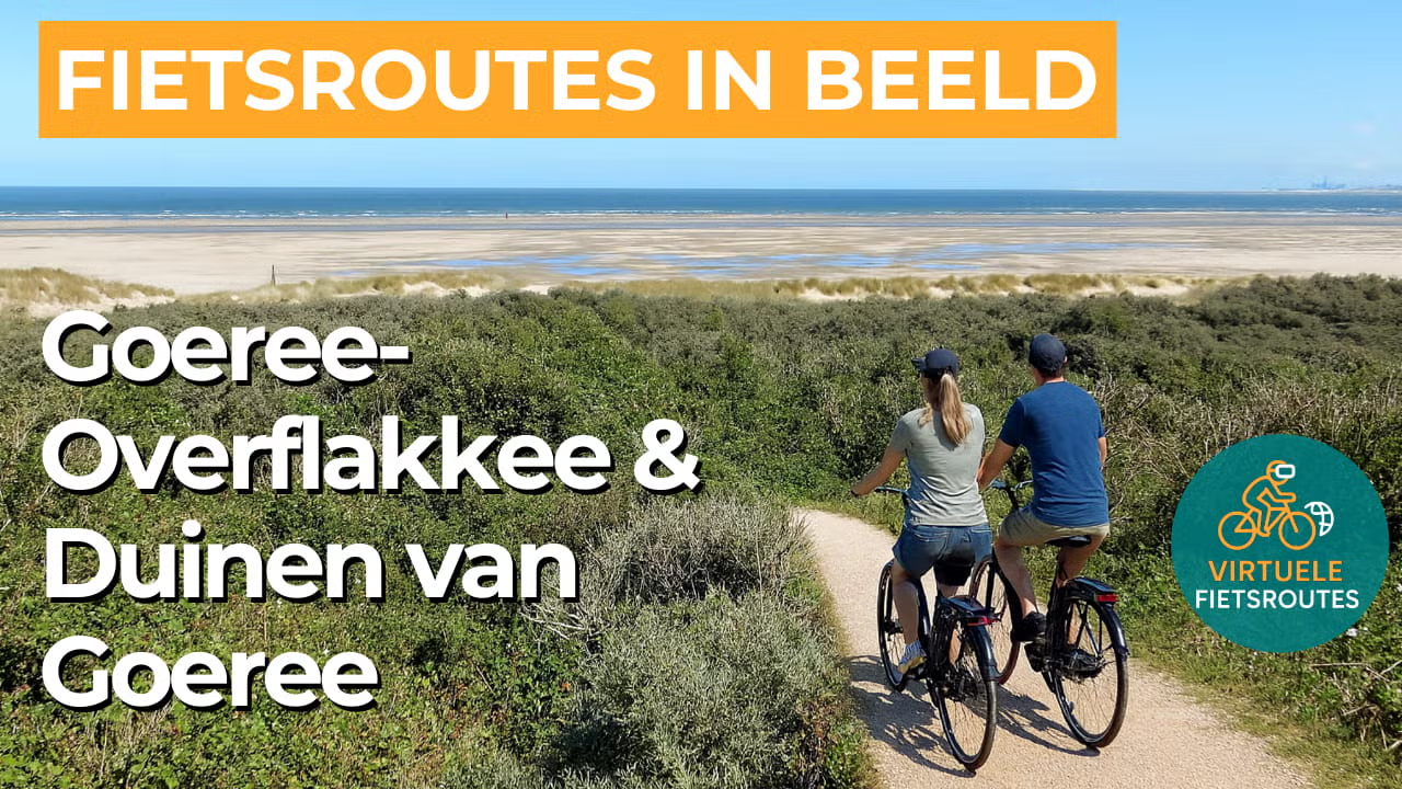
Along the coast of Goeree, you cycle through an open dune landscape filled with salty light and wide panoramic views. The dunes wind their way along the sea and the beach, so that every bend reveals a new panorama.
As soon as you leave the dunes behind, the island opens up into a landscape of dikes, polders and long straight lines of ditches and fields. You ride through a peaceful agricultural landscape where farmlands and grasslands alternate and the horizon is always within sight.
Along the edges of the creeks and behind the dikes lie wet nature areas where salt marshes and mudflats give the landscape a rugged character. Reed fringes, shallow pools and soft banks make this part of the route rich in birdsong and movement.
From the dikes, you look out across open water with quiet inlets and small islands, typical of the delta region. The proximity of the Grevelingenmeer gives the route a maritime atmosphere that can still be felt far inland.
Ride along with us on this virtual bike tour
Virtual cycling through Goeree-Overflakkee and the Duinen van Goeree takes you past wide beaches, salty dune landscapes and winding dikes with sweeping views. You experience the island atmosphere in full, with wind moving through the reed fringes and constantly changing panoramas between sea and land.
After that, you glide into the polders, where ditches, farmlands and grasslands set the rhythm and the horizon always remains close. Along the way, creeks, salt marshes and mudflats give the landscape a rugged delta atmosphere, with space everywhere for birds and tranquillity.
Want to learn more about virtual cycling? THIS IS HOW VIRTUAL CYCLING WORKS
Route map and cycling junctions
Start and finish at cycling junction 64 on the Meester Snijderweg in Stellendam. Because this is a circular route, you can also start at one of the other cycling junctions along the route.
Distance: 52 km
Estimated riding time: 3 hours 29 minutes
Elevation gain: 101 m
Paved roads: 87%
Unpaved / semi-paved: 13%
Ideal for: e-bikes and city bikes
Along the way: several options for a coffee break or lunch.


