
Cycling route Gooi and Vecht Region
Cycling through a typical peatland landscape with large and small lakes, dense swamp forests, historic buildings and stately estates.

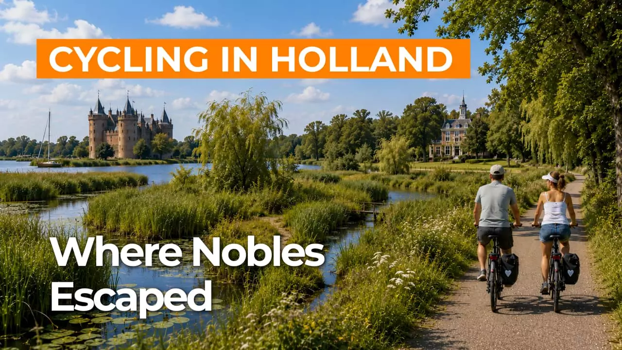
The Landscape
The Gooi and Vecht region is a quintessential Dutch peatland landscape of lakes, canals and narrow strips of land, where water and greenery set the rhythm. As part of the National Landscape Nieuwe Hollandse Waterlinie, the area feels especially distinctive thanks to the visible interplay of nature with forts, fortifications and other historic structures that give the landscape its story.
Between the Oostelijke Vechtplassen and the Naardermeer, open polders, reed beds and tranquil waters alternate, revealing ever-changing views along the route. This blend of expansive water, atmospheric swamp forests and stately estates makes the Gooi and Vecht region appealing to explore, both by bike and virtually.
What You’ll Discover Along the Way
Amid the wet peatlands, the route occasionally rises onto higher sandy ground, where forest edges and heathland suddenly transform the view. This contrast makes the ride especially engaging, shifting from sheltered woodland paths to open heath with wide skies and far-reaching vistas.
In the Gooi and Vecht region, nature and history lie close together, with stately estates and historic structures serving as landmarks along the route. Forts, fortifications and castles recall the defensive line of the New Dutch Waterline, adding an extra layer of story to the landscape.
Here, you cycle through a true peatland landscape shaped by water, canals and long, narrow strips of land that define the region’s pattern. In and around the Naardermeer, reed beds, swamp forests and flower-rich grasslands create a quiet, water-rich atmosphere.
The Oostelijke Vechtplassen offer expansive water views, with lakes that constantly change in appearance through shifting light, wind and reed-lined shores. Along the route, larger open waters alternate with smaller lakes, so you are almost always cycling beside the water.
Ride along with us on this virtual bike tour
Virtual cycling through the Gooi and Vecht region lets you glide through a quintessential Dutch peatland landscape of lakes, reed beds and long canals that divide the greenery into clean lines. Along the way, the Oostelijke Vechtplassen, open polders and swamp forests alternate, offering ever-changing water views and tranquil vistas.
At the same time, you travel through a landscape steeped in history, with forts, fortifications and stately estates that are part of the New Dutch Waterline. Each virtual ride becomes a relaxed journey of discovery, where nature and heritage continually enhance one another.
Want to learn more about virtual cycling? THIS IS HOW VIRTUAL CYCLING WORKS
Route map and cycling junctions
Start and finish near cycling junction 47 on the 's-Gravelandseweg in Weesp. Because this is a circular route, you can also start at one of the other cycling junctions along the route.
Distance: 53 km
Estimated riding time: 3 hours 32 minutes
Elevation gain: 84 m
Paved roads: 83%
Unpaved / semi-paved: 17%
Ideal for: e-bikes and city bikes
Along the way: several options for a coffee break or lunch.


