
Bicycle Node Network
To enjoy the beautiful surroundings of a cycling route in a carefree and relaxed way, good planning is essential. Thanks to the bicycle node network, it's easy to plan your own route.
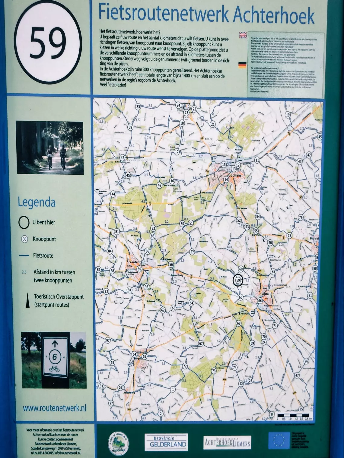
How does it work?

A bicycle node network is a collection of numbered junctions and the connections between them. At each junction, a sign displays the node number and indicates the direction to nearby nodes. The connecting routes are also marked with signs. This system allows for easy navigation, as a route can simply be followed by the sequence of node numbers.
The bicycle node network is clearly signposted with green and white signs displaying the node numbers. Using these numbered signs, you can cycle easily from one node to the next. The distances between nodes are indicated in kilometers on the information boards. To learn more, please watch the video about the Dutch bicycle node network.
Planning routes

You can find various bicycle route planners on the internet. Some of these planners are also available as apps. Most importantly, make sure to use an up-to-date route planner. Bicycle nodes are regularly changed or removed for various reasons — for example, due to the construction of a new road or a residential area, which may make it necessary to relocate or eliminate a particular node.
By using a route planner that regularly updates the bicycle node network, you significantly reduce the risk of missing a node. Of course, not every change in the network can be reflected in the route planners immediately. Therefore, I recommend regularly checking the information boards at the nodes.
Road and Surface Conditions on Cycle Routes
Cycle routes often lead through a wide variety of landscapes. The type of road surface plays an important role in comfort, safety, and suitability for different bikes. Whether you're cruising along coastal trails, pedalling through forests, or crossing rural farmland, the road surface adds its own character to the cycling experience.

Paved Roads
Smooth and stable surfaces such as asphalt, concrete, cobblestones, or tiles. These roads are ideal for all types of bicycles and ensure easy riding in all weather conditions.
Semi-Paved Paths
Surfaces like gravel, shell trails, bound sand, or marl offer a natural feel with moderate comfort. They're well-suited for touring bikes and e-bikes, but may be less comfortable for racing bikes.
Unpaved Tracks
Paths of sand, grass, clay, or forest soil bring you closer to nature, but can be challenging in wet conditions. Perfect for mountain bikers and adventurous cyclists looking for scenic and quiet routes.


