
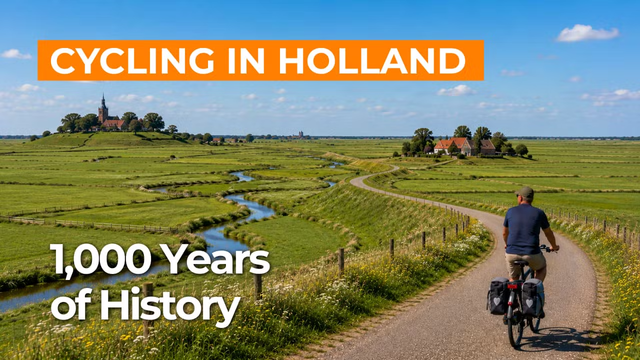
Cycling route National Landscape Middag-Humsterland
Cycle through a centuries-old dwelling mound landscape, where vast clay polders, quiet dike roads, characteristic villages, and winding waterways shape the rhythm of the land.
The Landscape
Between the Wadden Sea and the Lauwersmeer lies National Landscape Middag-Humsterland, one of the oldest and best-preserved cultural landscapes in the Netherlands. Cycle through a tranquil, open clay region with sweeping views, historic dikes, and man-made dwelling mounds rising like green islands above the land.
Ancient tidal channels and narrow winding roads connect historic dwelling mound villages with brick churches and farmsteads that have shaped the landscape for centuries. Throughout the area, the interplay between water and human ingenuity is visible in the salt marshes, field patterns, and waterways that give this region its timeless character.
What You’ll Discover Along the Way
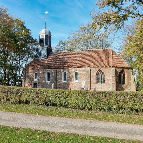
In Middag-Humsterland, you cycle past centuries-old terp villages such as Ezinge, Garnwerd, and Niehove, where church, mound, and farmstead naturally shape the landscape. Along the way, you encounter Groninger heritage at historic estates like the Allersmaborg and the Piloersemaborg, and in Aduard, where the monastic past remains clearly visible.
This open clay landscape was shaped by the sea, salt marshes, dikes, and centuries of farming, with long sightlines stretching across fields and grasslands. Subtle elevation changes, historic dike alignments, and distinctive field patterns give the route a calm and spacious character.
Water is ever-present in the Reitdiep area, with the Reitdiep and the Aduarderdiep clearly shaping both the landscape and the route. At Aduarderzijl, you can see how locks and waterways have controlled water levels and drainage for centuries, while cycling along the water adds a sense of light and openness to the journey.
Join our virtual bike tour and experience the journey
Virtual cycling through National Landscape Middag-Humsterland lets you experience the historic dwelling mound landscape from home, with open clay polders, quiet dike roads, and villages rising on the horizon. In the video, you ride past churches, farmsteads, and winding roads, creating a calm and natural sense of the route.
The Reitdiep and Aduarderdiep give the ride a distinctly water-rich character, with sluices and locks serving as recognizable landmarks along the way. Ideal for relaxed indoor cycling on a home trainer or for previewing the route in advance.
Want to learn more about virtual cycling? THIS IS HOW VIRTUAL CYCLING WORKS
Route map and cycling junctions
Start and finish near cycling junction 59 on the Burgemeester van Barneveldweg in Aduard. Because this is a circular route, you can also start at one of the other cycling junctions along the route.
Distance: 46 km
Estimated riding time: 3 hours 5 minutes
Elevation gain: 18 m
Paved roads: 96%
Unpaved / semi-paved: 4%
Ideal for: e-bikes and city bikes
Along the way: several options for a coffee break or lunch.


