
Cycling route Gelderse Poort and Lingewaard
Cycling through a historic river landscape of dikes and floodplains, green riverbanks, quiet oxbow lakes, open polders, hawthorn hedges and blooming traditional orchards.

The Landscape
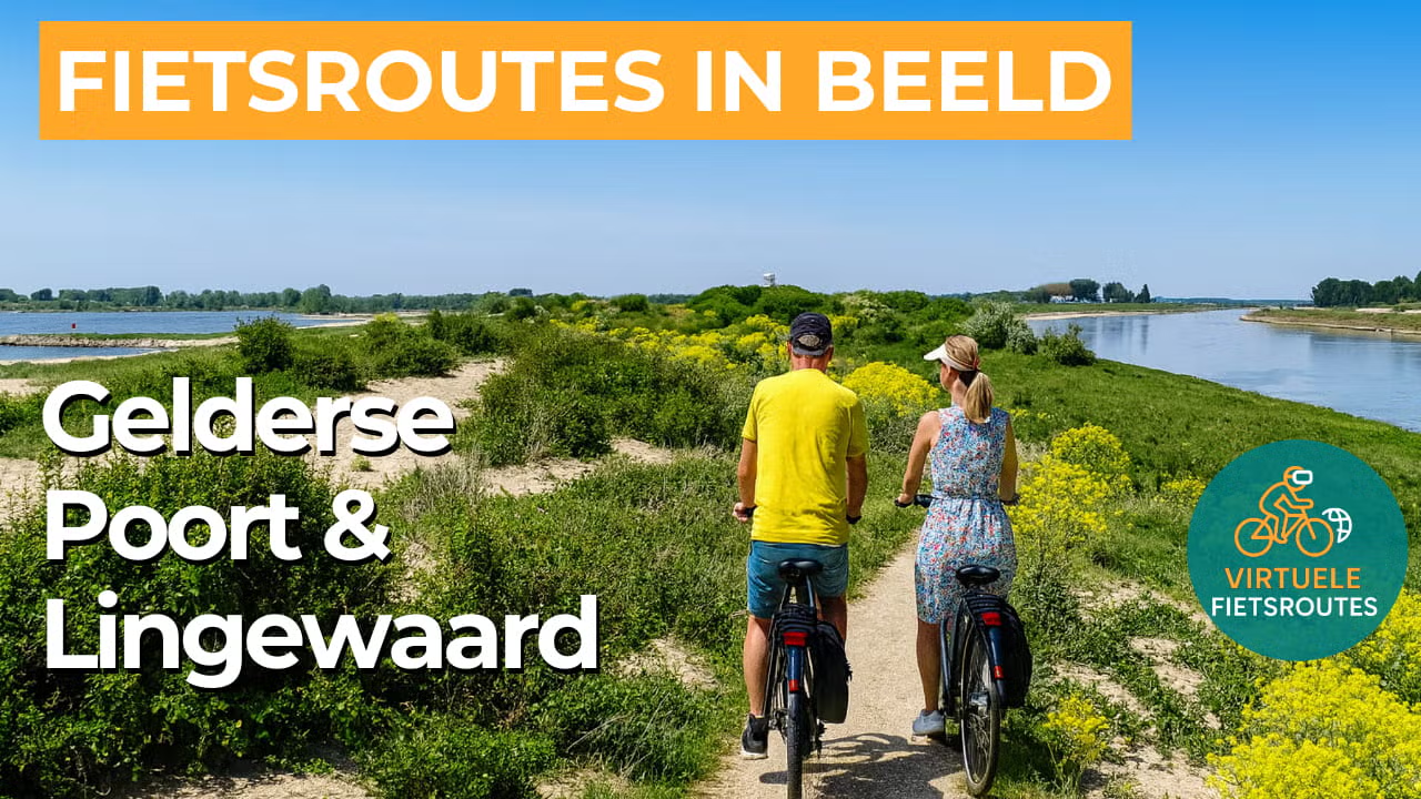
In the Gelderse Poort, you experience the Netherlands at its most dynamic, where water, wind and clay shape a landscape of dikes, side channels and wide floodplains. At the river bifurcation of the Rhine, Waal and Nederrijn, you can see how the river has been given room again, with side channels, floodplain forests and flower-rich grasslands that change with the seasons. Semi-wild cattle and horses keep the vegetation open, while the area is known for its rich birdlife and wide, open views.
Lingewaard feels like a green transition between Arnhem and Nijmegen, with winding dikes, fruit growing and a calm, rural rhythm. In spring, the orchards are filled with blossom, and later in the year the branches hang heavy with fruit, while oxbow lakes, river beaches and patches of floodplain woodland make the presence of water tangible. The region’s history is also visible in the floodplains, where the brick industry long relied on river clay, leaving behind distinctive chimneys and old factory remains as industrial heritage.
What You’ll Discover Along the Way
In Lingewaard, you cycle past dike villages, old field roads and heritage that has structured the river landscape for centuries. Kasteel Doornenburg stands out as a strong focal point in the greenery, set in surroundings where history and landscape blend seamlessly. In several places, remains of brickworks recall a time when clay and water shaped everyday life.
Behind the dikes, the landscape opens into a clear polder scene of arable fields, grasslands and long, ordered lines that bring a sense of calm to the route. Hawthorn hedges, farmyard planting and traditional standard orchards create a small-scale Betuwe atmosphere, especially around the villages and hamlets. It is precisely the contrast between open land and sheltered edges that keeps this part of the route lively.
Large lakes are absent, but in the floodplains you’ll find wheels and oxbow lakes that give the landscape a quiet sense of depth. Along reed beds and rough riverbanks, you often feel as if you are cycling through a natural waterscape, with ever-changing views of the river. On warm days, the water glints between the greenery, making the route feel especially light and open.
The great rivers are the common thread of this route, with dikes, floodplains and wide waterscapes recurring throughout. The Waal, the Nederrijn and the Pannerdensch Kanaal give the area its powerful dynamism, with side channels and sandy banks that keep the landscape in constant motion. In Lingewaard, the Linge softens this image with a greener, more intimate river experience along orchards and dike roads.
Ride along with us on this virtual bike tour
Virtually cycling through the Gelderse Poort and Lingewaard lets you experience the power of the river landscape, with dikes, floodplains and wide waterscapes along the Waal, Nederrijn and Pannerdensch Kanaal. You ride through a dynamic natural area where floodplain forests, side channels and grazing cattle and horses give the landscape a different character in every season.
In Lingewaard, open polders, hawthorn hedges and traditional standard orchards alternate, creating a calm rural rhythm between Arnhem and Nijmegen. Along the way, you pass recognisable landmarks such as Kasteel Doornenburg and traces of the brick industry, where nature and heritage come together seamlessly in a single route.
Want to learn more about virtual cycling? THIS IS HOW VIRTUAL CYCLING WORKS
Route map and cycling junctions
Start and finish near cycling junction 66 at the Looveer in Huissen. Because this is a circular route, you can also start at one of the other cycling junctions along the route.
Distance: 51 km
Estimated riding time: 3 hours 25 minutes
Elevation gain: 83 m
Paved roads: 90%
Unpaved / semi-paved: 10%
Ideal for: e-bikes and city bikes
Along the way: several options for a coffee break or lunch.


