
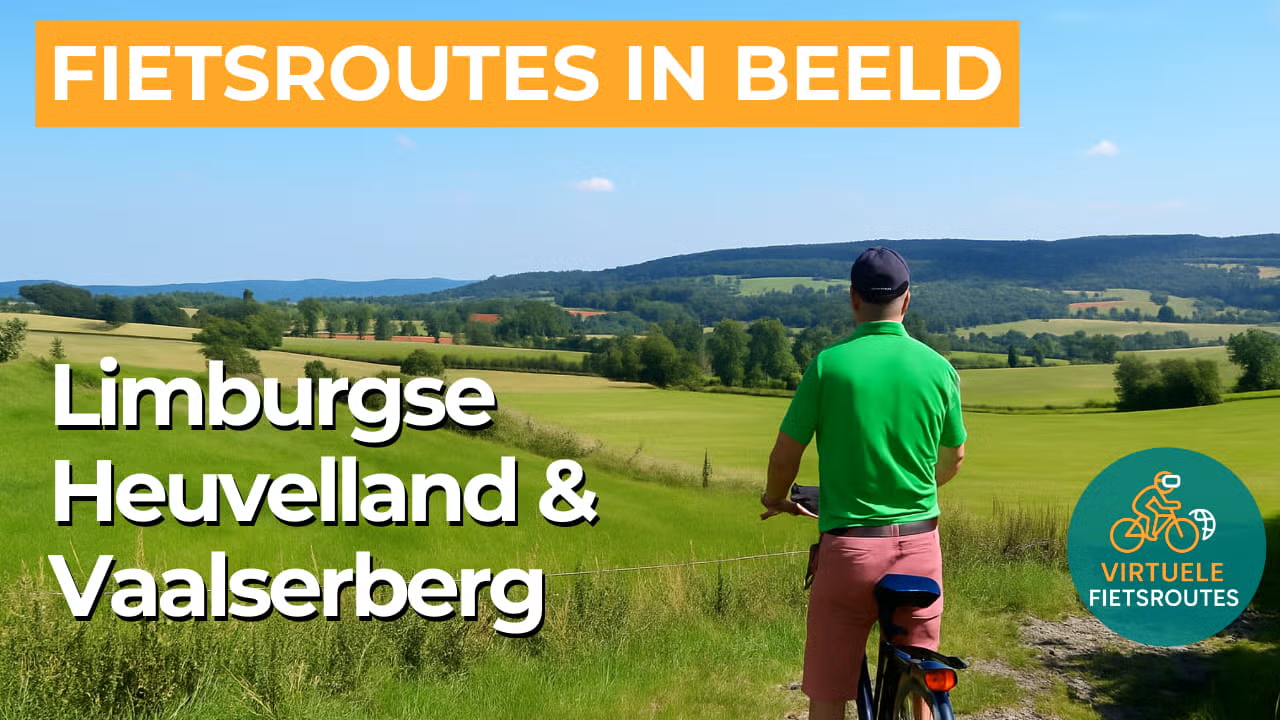
Cycling route Limburgse Heuvelland and Vaalserberg
Cycle through a hilly landscape with stunning panoramic views from the highest point in the Netherlands.
The Landscape
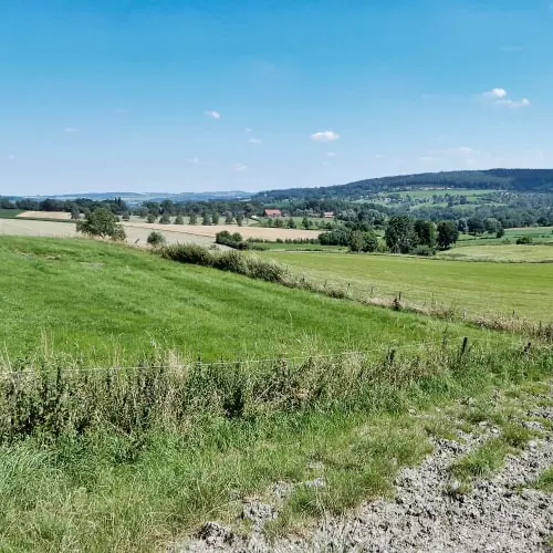
The Limburgse Heuvelland is one of the Netherlands’ most popular cycling regions, where rolling hills, green orchards and open farmland unfold in a gentle rhythm. The Geul and the Gulp wind through the valleys, shaping the landscape’s soft contours, while half-timbered farmhouses, sunken lanes and traditional hedgerows create the distinctive atmosphere of South Limburg.
Towards Vaals, the terrain becomes more challenging as you climb towards the Vaalserberg, where sweeping panoramas open up across villages, forests and the border region. Along the way, you also ride a scenic stretch through Belgium past Plombières and Kelmis, where the landscape feels like a natural extension of South Limburg and the international setting becomes clearly visible. Nearby lies the Drielandenpunt, a unique spot where the Netherlands, Belgium and Germany meet, offering views of the surrounding hills from multiple directions.
What You’ll Discover Along the Way
Around Vaals, you cycle through cool hillside forests where beech and oak filter the light, giving the route ever-changing views. On open stretches of heath and grassy slopes, you look out across the South Limburg hills, with the border region towards Aachen visible in the distance. The mix of shaded paths and sunlit slopes adds extra variety to this scenic ride.
Along the way, you pass stately farmsteads, traditional half-timbered houses and small chapels that give the landscape its distinctive character. Historic lanes often follow centuries-old routes, guiding you through a setting where culture and nature blend seamlessly. In the villages, a welcoming Burgundian atmosphere comes to life on squares and terraces, perfect for a relaxing break.
In the Heuvelland, meadows, fields and orchards form a colorful mosaic, edged by hedgerows and tree lines. You ride along quiet country roads where cattle graze and fruit trees are heavy with produce in season, while small valleys appear between the open fields, marked by green ribbons of winding streams.
The climbs towards the Vaalserberg give the route a sporty rhythm, with winding roads and occasional sunken lanes between high embankments. From the higher points, wide panoramas open up across the Limburgse Heuvelland and the surroundings of Vaals, while in the valleys the ride becomes more relaxed again, following stream valleys and sheltered green corridors.
Join our virtual bike tour and experience the journey
Virtual cycling through the Limburgse Heuvelland and towards the Vaalserberg lets you enjoy rolling slopes, winding roads and sweeping views that make every kilometer unique, as you ride past orchards, half-timbered villages and green valleys shaped by the gentle flow of the Geul and the Gulp.
On the climb to the highest point in the Netherlands, a wide panorama unfolds across villages, forests and the border region near Vaals. This virtual cycling route also lets you experience the international atmosphere towards Belgium and the Drielandenpunt, just as you would on the road.
Want to learn more about virtual cycling? THIS IS HOW VIRTUAL CYCLING WORKS
Route map and cycling junctions
Start and finish near cycling junction 20 at the Landsraderweg in Gulpen. Because this is a circular route, you can also start at one of the other cycling junctions along the route.
Distance: 46 km
Estimated riding time: 3 hours 5 minutes
Elevation gain: 637 m
Paved roads: 93%
Unpaved / semi-paved: 7%
Ideal for: e-bikes and city bikes
Along the way: several options for a coffee break or lunch.


