
Cycling routeLoonse en Drunense Duinen and Moerputten
Cycle through a striking mix of drifting sands, pine forests, heathland, and wet marshes, with open views and quiet reed beds along the way.

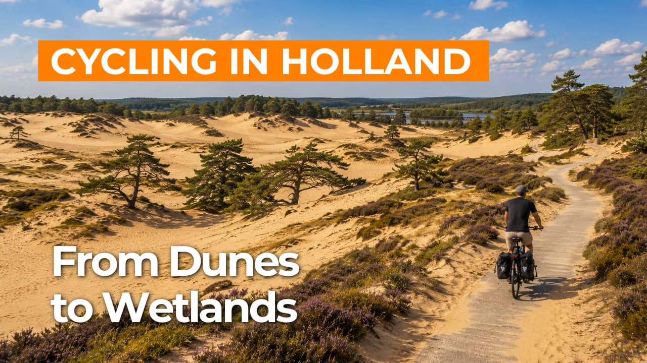
The Landscape
The Loonse en Drunense Duinen, together with the Vughtse Heide and the area around the IJzeren Man, form a varied mosaic of sand flats, pine forests, heathland, and recreational waters. This is one of the largest drifting sand landscapes in Western Europe, where wind and sand continue to shape the terrain, revealing a new panorama around every bend. Around the Vughtse Heide, nature is interwoven with tangible history, including memorial sites and traces of military use, while the IJzeren Man offers a more relaxed cycling experience in a green, accessible setting.
To the west of ’s-Hertogenbosch, the Moerputten form a rare remnant of an ancient lowland peat bog where water defines the landscape. Reed beds, marsh forests, and flower-rich grasslands provide an important habitat for birds, butterflies, and unique plant species. The nearby Vlijmens Veen connects seamlessly, with wet hay meadows, pools, and alder carrs creating a continuous, bird-rich wetland landscape to cycle through.
What You’ll Discover Along the Way
In the Duinen, you cycle through long stretches of pine forest that suddenly open onto heathland and rolling sand slopes. The light, the scent of pine, and the gentle relief create an almost un-Dutch atmosphere. Along the transitions between forest edges and drifting sands, you truly experience the space and dynamism of this landscape.
Beyond the core nature areas, the route unfolds into a peaceful Brabant countryside of fields, meadows, and farmsteads along quiet roads. Wide views and an open horizon define the scenery, with small hamlets adding a familiar rural backdrop. This balance between untamed landscapes and cultivated land makes the ride especially enjoyable.
Around the IJzeren Man, lakes and open water bring a sense of space and offer a perfect spot for a relaxing break along the route. In the Moerputten and Vlijmens Veen, the scenery shifts to quiet pools and wetland zones where reed beds and reflective water soften the landscape. With a bit of luck, you may spot waterbirds gliding low over the marsh.
Ditches, waterways, and damp edges trace subtle lines through the landscape, linking dry sandy soils with marshland. Along these moist corridors, the scenery turns greener and cooler, naturally slowing your pace. Here, you truly sense how strongly water shapes the character of the route.
Ride along with us on this virtual bike tour
Virtual cycling through the Loonse en Drunense Duinen and the Moerputten lets you experience a unique blend of drifting sands, heathland, and extensive pine forests. As the landscape gently unfolds, you take in the silence and wide-open space of one of Brabant’s most distinctive natural areas.
In the wetland landscapes of the Moerputten and Vlijmens Veen, the scenery shifts to reed beds, open water, and lush marsh forests teeming with life. This virtual cycling route is perfect for a relaxed ride at home while still feeling fully immersed in nature.
Want to learn more about virtual cycling? THIS IS HOW VIRTUAL CYCLING WORKS
Route map and cycling junctions
Start and finish at cycling junction 35 on the Oude Bossche Baan in Biezenmortel. Because this is a circular route, you can also start at one of the other cycling junctions along the route.
Distance: 49 km
Estimated riding time: 3 hours 17 minutes
Elevation gain: 73 m
Paved roads: 94%
Unpaved / semi-paved: 6%
Ideal for: e-bikes and city bikes
Along the way: several options for a coffee break or lunch.


