
Cycling route Alblasserwaard and UNESCO World Heritage Kinderdijk
Cycling through a centuries old polder landscape of ditches and canals, river dunes and pollard willows, with the windmills of Kinderdijk as an iconic backdrop.

The Landscape
The Alblasserwaard is an open, water rich peat meadow landscape where dikes, ditches and canals set the rhythm and wide open views are everywhere. Between the great rivers Lek, Merwede and Noord, you can see how centuries of land reclamation and water management have shaped the land, with long narrow fields, green grasslands and ribbons of villages built on the higher edges.
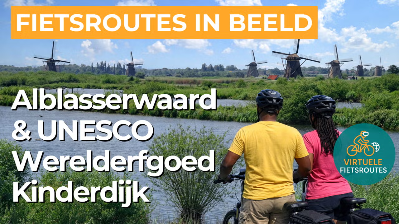
Kinderdijk forms a distinctive landmark within this polder landscape, where the interplay of windmills, drainage basins and embankments still shows how the Netherlands learned to control the water. The network of waterways and mill channels makes this area unique, which is exactly why Kinderdijk is known worldwide as a UNESCO World Heritage Site.
What You’ll Discover Along the Way
Around Kinderdijk, everything revolves around water and craftsmanship, with windmills, embankments and drainage basins that have regulated the water levels of the Alblasserwaard for centuries. Along the way, you pass historic dike ribbons, farmhouses and old hydraulic structures, giving the route a story at every turn. Here, the heritage does not feel like a museum, but like a landscape that is still very much alive and functioning.
The polders lie like open rooms behind low dikes, with long narrow fields, shimmering ditches and grasslands filled with cows and pollard willows. The clean lines and expansive skies allow you to see far into the distance, while narrow roads and dikes guide you smoothly through the landscape. It is precisely this sense of calm and openness that makes the route so typically Dutch.
Behind the dikes, the peat landscape remains visible in wet grasslands, reed fringes and soft banks where birds and wind bring constant movement. In areas such as the Donkse Laagten, the scenery becomes quieter and more rugged, with water lying close to the surface in many places. Here, the pace naturally slows down, because the landscape invites you to look more closely.
Along the edges, you can feel the presence of the Lek, the Merwede and the Noord, with dikes, floodplains and wide open skies constantly returning in the view. Smaller waterways such as the Alblas and the Giessen also run through the Alblasserwaard, dividing the area into a fine meshed network and adding extra variety to the route. This means you are constantly cycling between broad river landscapes and intimate polder waters.
Ride along with us on this virtual bike tour
Virtual cycling through the Alblasserwaard and the UNESCO World Heritage Site of Kinderdijk takes you through a vast peat meadow landscape of long narrow fields, shimmering ditches and dikes that naturally shape the land. Between pollard willows, grazing cows and quiet polders, the horizon remains wide open and the rhythm of water and wind is felt everywhere.
At Kinderdijk, the landscape merges seamlessly into world famous heritage, where windmills, drainage basins and embankments together tell the story of Dutch water management. You ride along the iconic row of windmills and experience why this place forms such a powerful combination of engineering, history and polder tranquillity.
Want to learn more about virtual cycling? THIS IS HOW VIRTUAL CYCLING WORKS
Route map and cycling junctions
Start and finish near cycling junction 10 on the Peilkade in Papendrecht. Because this is a circular route, you can also start at one of the other cycling junctions along the route.
Distance: 54 km
Estimated riding time: 3 hours 38 minutes
Elevation gain: 13 m
Paved roads: 94%
Unpaved / semi-paved: 6%
Ideal for: e-bikes and city bikes
Along the way: several options for a coffee break or lunch.


