
Cycling route National Landscape Noordoost-Twente
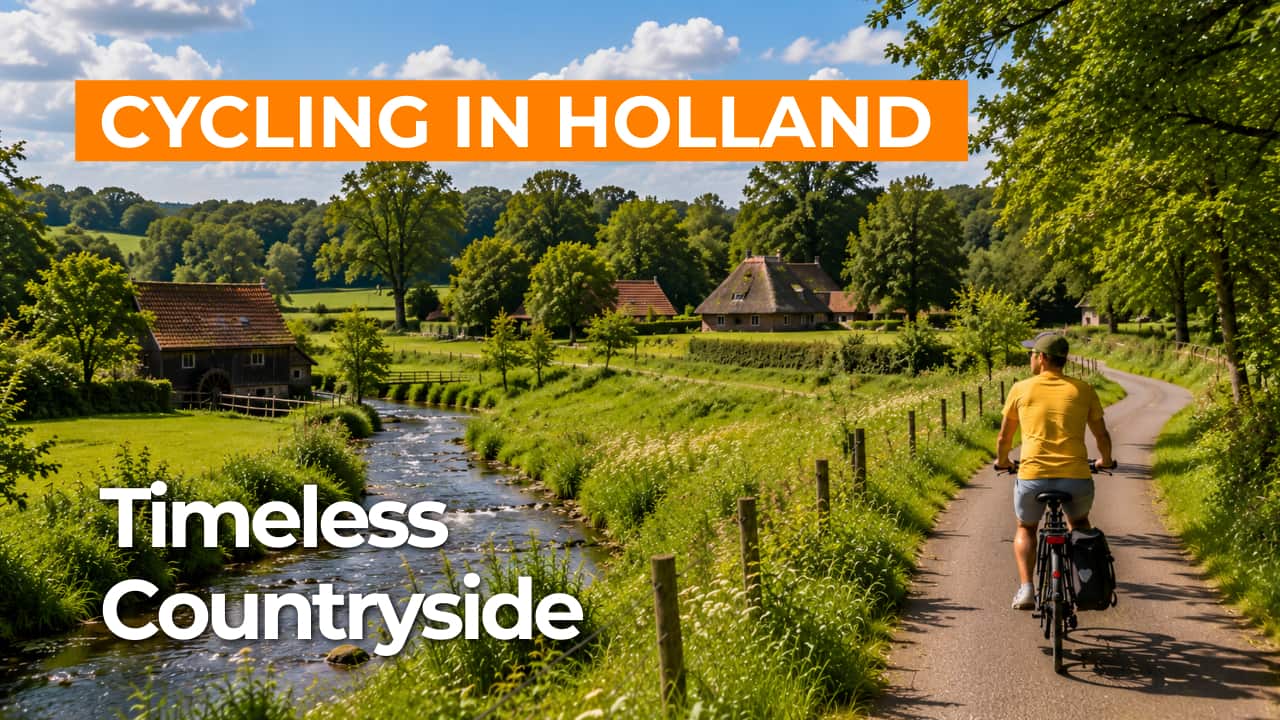
Cycling through the Twente bocage landscape around Ootmarsum, with spring-fed streams, centuries-old farmsteads, park-like woodlands and gentle elevation changes.
The Landscape
National Landscape Noordoost-Twente is a small-scale mosaic of elevated arable fields, enclosed plots and stream valleys, shaped by Ice Age processes and centuries of farming. During the penultimate Ice Age, glacial ridges formed around Oldenzaal and Ootmarsum, while the lower areas developed into wet stream valleys with springs and marshy woodland.
On the higher grounds, elevated arable fields developed in the early Middle Ages around villages and hamlets, with hedgerows marking field boundaries and creating intimate views. Variations in elevation, diverse soils and abundant water ensure a constant interplay of meadows, woodland edges, ponds and winding streams. For those who want to experience the character of Twente, this route brings together nature, history and farming in a landscape where all remain clearly visible.
What You’ll Discover Along the Way
You cycle through quiet woodland sections with beech-lined avenues, pine stands and sheltered paths where light filters softly through the canopy. Around the Springendal, small heathland patches and ponds open up the landscape, with short climbs and unexpected views towards the gently rolling edges.
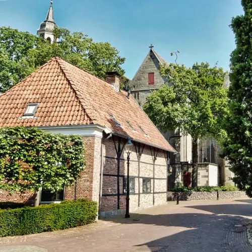
Around Ootmarsum, characteristic farmsteads and Saxon-style farms are often tucked behind tree lines and old oaks. Country estates with tree-lined driveways, historic watermills and subtle cultural features along the route create a setting rich in tranquillity and history.
Elevated fields, arable land and green pastures lie side by side like open rooms, bordered by hedgerows that break the wind and guide the view. You ride past grain fields, grazing cattle and farmyard planting, as the route alternates between open stretches and sheltered sections.
The Dinkel and numerous spring-fed streams wind through moist valleys with alders, reed fringes and flower-rich banks. Crossing small bridges and following gentle bends, you stay close to the water, keeping the landscape lively while maintaining a calm, unhurried feel.
Ride along with us on this virtual bike tour
Virtual cycling through Northeast Twente lets you experience the natural rhythm of the landscape, with gentle curves along hedgerows and ever-changing views across elevated fields and stream valleys. You move between shaded woodland sections and open farmland, just as you would on the route itself.
From your indoor trainer, you follow spring-fed streams and winding brooks at a relaxed pace, while estates and farmsteads give the scenery a timeless feel. Ideal for exploring Twente in any season, or as preparation for a real cycling tour around Ootmarsum and the Springendal.
Want to learn more about virtual cycling? THIS IS HOW VIRTUAL CYCLING WORKS
Route map and cycling junctions
Start and finish near cycling junction 69 on the Markt in Ootmarsum. Because this is a circular route, you can also start at one of the other cycling junctions along the route.
Distance: 57 km
Estimated riding time: 3 hours 48 minutes
Elevation gain: 172 m
Paved roads: 79%
Unpaved / semi-paved: 21%
Ideal for: e-bikes and city bikes
Along the way: several options for a coffee break or lunch.


