
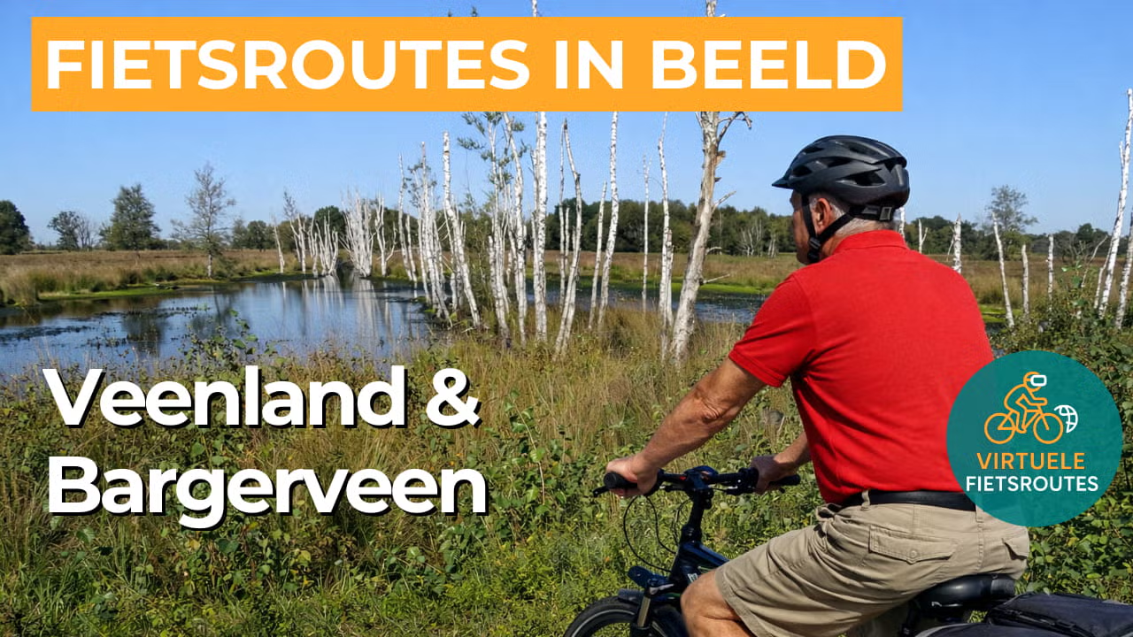
Cycling route Veenland and Bargerveen
Cycle through the rugged beauty of the largest continuous raised bog area in the Netherlands, a unique landscape of wetlands, open heath, and untouched nature.
The Landscape
After the last Ice Age, the climate became warmer and wetter. In the stream valleys of Drenthe, broad marshy zones developed where sphagnum moss grew layer upon layer, shaping a landscape that can still be recognized today around Klazienaveen, Zwartemeer, and Emmen. This process gave rise to an extensive raised bog landscape that once stretched from the Hunze to the Ems. In the Middle Ages, the Bourtange Moor is estimated to have covered around 300,000 hectares, with peat layers reaching up to 12 meters in some places. Peat extraction, land reclamation, and later agriculture and forestry transformed the area profoundly, yet the main outlines of this peatland story remain clearly visible in the landscape.
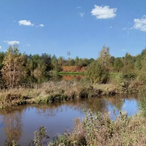
The Bargerveen is the last large, still-living remnant of the original Bourtange Moor in the Netherlands. This nature reserve covers more than 2,000 hectares and is one of the few places where active raised bog can still grow and gradually recover. The cycling route takes you past peat hummocks and vast fields of sphagnum moss, as well as wet marshes, carr woodlands, and small pools that lie like mirrors in the greenery. Here and there, you will see reed beds and narrow waterways cutting through the peatland, giving the area a rugged, water-rich character. As a result, the landscape here feels different from elsewhere in Drenthe, with an open horizon, wide skies, and a silence that almost naturally makes you slow down as you cycle.
What You’ll Discover Along the Way
Along the edges of the peatland, strips of woodland alternate with heathland. At times you cycle sheltered beneath the trees, after which the view opens again onto flat, expansive stretches with plenty of sky and space.
Along the route, traces of peat extraction and the history of the area around Klazienaveen can be seen. Historic structures and old settlements tell the story of people and the landscape.
In the area around Klazienaveen, you cycle through open farmland with a clear, linear field pattern. The long sightlines and the calm rhythm of the landscape make this section ideal for maintaining a steady pace.
Closer to the Bargerveen, the wet peatland landscape dominates, with fens and marshy zones. Here, the route feels quieter and more untamed, with a good chance of spotting special birdlife and a landscape that constantly looks just a little different.
Ride along with us on this virtual bike tour
With this virtual cycling route, you can experience the peatland around Klazienaveen and the Bargerveen at your own pace. Ideal for use on a home trainer, but also perfect for exploring the route in advance before heading out to cycle in Southeast Drenthe.
Along the way, you get a clear sense of the contrast between the orderly reclaimed landscape and the rugged nature of the raised bog. You cycle through an area with long sightlines, quiet pools, and wet peatlands, where peace and space set the tone and nature always feels close by.
Want to learn more about virtual cycling? THIS IS HOW VIRTUAL CYCLING WORKS
Route map and cycling junctions
Start and finish near cycling junction 33 on the Ambachtsweg in Weiteveen. Because this is a circular route, you can also start at one of the other cycling junctions along the route.
Distance: 47 km
Estimated riding time: 3 hours 9 minutes
Elevation gain: 69 m
Paved roads: 78%
Unpaved / semi-paved: 22%
Ideal for: e-bikes and city bikes
Along the way: several options for a coffee break or lunch.


