
Cycling route Eastern Flevoland and IJsseldelta
Cycle through a water-rich landscape of polders and rivers, with fields changing color through the seasons, young forests, expansive lakes, reed-lined shores, and winding dikes.
The Landscape
Eastern Flevoland is a young polder, designed in the mid-twentieth century and developed step by step. The orderly field patterns and straight roads around Dronten define its clear structure, while the openness brings space, light, and expansive skies. Along canals, ditches, and lakes, colorful fields and orchards alternate with green polder forests and wilder nature zones that attract abundant birdlife.
At the edge of the polder, the IJsseldelta begins, where the IJssel and the Zwarte Water set the rhythm of the landscape. Around Zwolle, Kampen, and Hasselt, rivers, floodplains, and polders come together in an area of long dikes, reed beds, and historic creek ridges. Here, you can see how water and people have shaped each other for centuries, with dikes and embankments protecting the land while providing access to historic waterside locations.
What You’ll Discover Along the Way
Around Dronten, you cycle through polder forests such as Abbertbos and Roggebotzand, with wide paths, open edges, and abundant birdlife. On the sandy transitions and within the shelter of the greenery, the route feels surprisingly natural for such a young polder.
In Eastern Flevoland, you ride past long plots, straight polder roads, and open fields with views stretching to the horizon. Farmsteads, wind turbines, and changing crops create a shifting palette through the seasons, from fresh green to golden yellow and deep red.
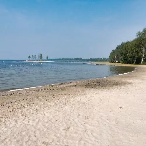
Along the Veluwemeer, Drontermeer, Vossemeer, and Ketelmeer, the route follows reed-lined shores, small beaches, and viewpoints rich in waterbirds. Light reflecting off the water and wide-open banks make this section ideal for those who enjoy fresh air and panoramic views.
Between Kampen and the Randmeren lies an open transition zone where river, polder, and inland lakes merge into one landscape. Near Kampen, you still sense the dynamics of the IJssel, with dikes, floodplains, and former channels revealing how water has shaped the area for centuries.
Ride along with us on this virtual bike tour
This virtual cycling route takes you through Eastern Flevoland and the IJsseldelta, a varied landscape of polders and water that is ideal for indoor training on a home trainer. You ride through a classic planned landscape of straight polder roads, orderly fields, and wide floodplains that create a sense of calm and open space.
Along the way, colorful fields and blossoming orchards alternate with bird-rich lakes, reed-lined shores, and green polder forests. This creates a vivid picture of Flevoland’s natural and agricultural landscape, with ever-changing views and a true outdoor experience from home.
Want to learn more about virtual cycling? THIS IS HOW VIRTUAL CYCLING WORKS

Route map and cycling junctions
Start and finish near cycling junction 6 at the Roggebotweg in Dronten. Because this is a circular route, you can also start at one of the other cycling junctions along the route.
Distance: 50 km
Estimated riding time: 3 hours 20 minutes
Elevation gain: 55 m
Paved roads: 100%
Ideal for: e-bikes and city bikes
Along the way: several options for a coffee break or lunch.


