
Cycling route National Park Weerribben-Wieden and Giethoorn
Cycle through an open landscape of canals, waterways, lakes, marshes, wide reed beds and historic farmsteads.

The Landscape
National Park Weerribben-Wieden is a rare water rich mosaic of reeds, peat and open lakes, shaped by centuries of peat extraction and further sculpted by nature. You cycle through the largest continuous low peat marsh in northwestern Europe, passing peat ponds and narrow peat ridges, reed beds and hay meadows, with canals and ditches weaving through the landscape everywhere. Hidden between the waterways lie swamp forests, while thatched farmhouses and old workers’ cottages recall the lives of reed cutters and peat workers.
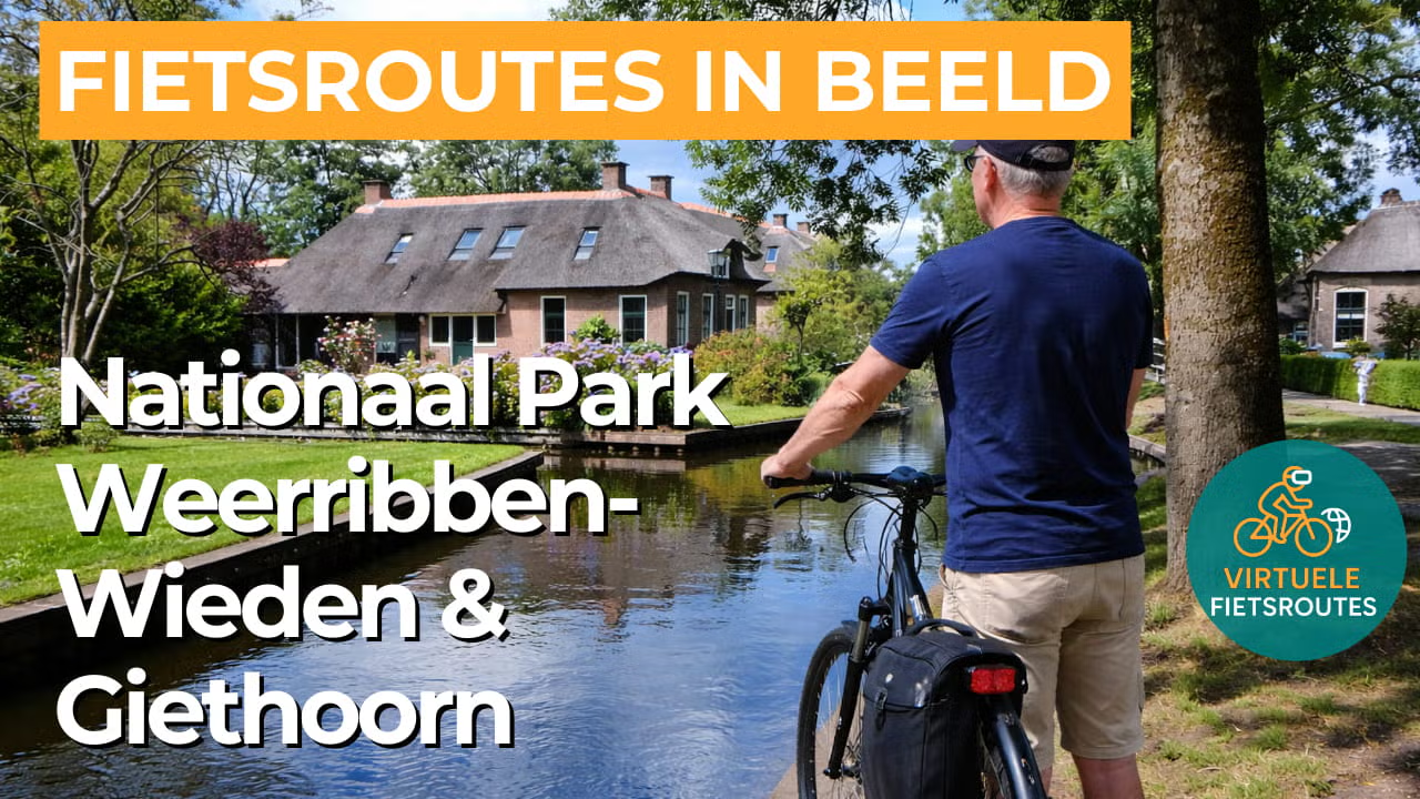
Giethoorn lies in the heart of De Wieden and is known for its canals, small bridges and thatched farmhouses. Often called the “Venice of the Netherlands,” the village was shaped by a landscape that gained its distinctive water structure through peat extraction. The traditional punter boat remains part of the village’s identity, and as soon as you cycle beyond the busiest areas, the gentle sound of water, the scent of reeds and the silence of the marshland quickly take over again.
What You’ll Discover Along the Way
During this cycling route, you ride past quiet swamp forests and green woodland edges where alders and willows almost touch the water. On the slightly higher and drier stretches, the landscape briefly feels more solid and sheltered before opening once again into reeds and waterways.
In National Park Weerribben-Wieden, traces of the peat cutting era are visible everywhere, with peat ponds, narrow peat ridges and canals telling the story of land reclamation and water management. In Giethoorn, canals, wooden bridges and thatched farmhouses give the route a distinctive and almost timeless atmosphere.
Here, you experience an expansive low peat marsh landscape of reed beds, ditches and wet peat edges where water and vegetation exist in a constant natural balance. Every bend reveals a new marshland scene, ranging from floating peat bogs to sheltered swamp woodlands.
On the open lakes, such as Belterwijde and Beulakerwijde, you experience the wide open character of the Kop van Overijssel, where sky, water and reeds merge into a single panorama. The route follows the edges of the water, constantly alternating between sheltered shores and broad open views.
Ride along with us on this virtual bike tour
Virtual cycling through National Park Weerribben-Wieden and Giethoorn lets you experience from home the unique low peat marsh landscape where peat ponds, narrow peat ridges, reed beds and quiet waterways create an endless mosaic of water and greenery. You ride past swamp forests and wide reed fringes, with constantly changing views across open lakes and bird rich shores.
In the video, you cycle through Giethoorn, where canals, wooden bridges and thatched farmhouses give the famous water village its distinctive character. As soon as you leave the centre behind, the tranquillity returns and the route once again follows the water rich edges of De Wieden, with long sightlines and that characteristic sense of open space.
Want to learn more about virtual cycling? THIS IS HOW VIRTUAL CYCLING WORKS
Route map and cycling junctions
Start and finish near cycling junction 61 on the Eendrachtsplein in Giethoorn. Because this is a circular route, you can also start at one of the other cycling junctions along the route.
Distance: 56 km
Estimated riding time: 3 hours 44 minutes
Elevation gain: 5 m
Paved roads: 95%
Unpaved / semi-paved: 5%
Ideal for: e-bikes and city bikes
Along the way: several options for a coffee break or lunch.


