
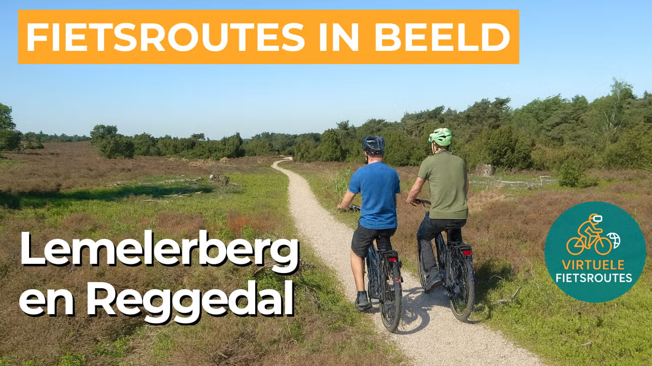
Cycling route Lemelerberg and Regge Valley
Cycling through a varied landscape of rolling farmland, winding rivers, mixed forests, heathlands, and drifting sand dunes.
The Landscape
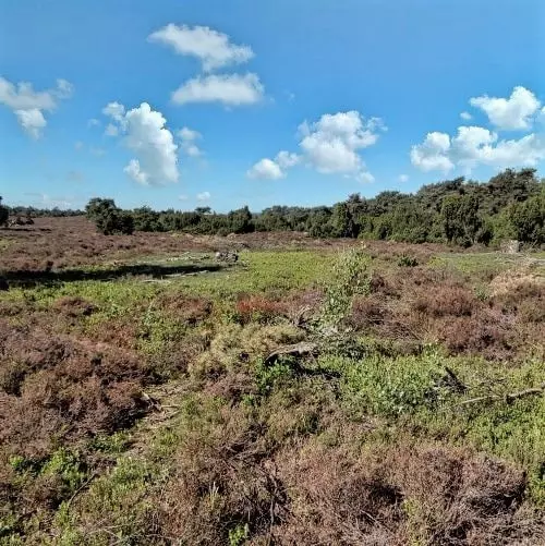
The Lemelerberg is a prominent hill just south of Ommen and, at 78 metres above sea level, one of the highest points in Salland. This glacial ridge was formed during the Ice Age, when advancing glaciers pushed up sand and gravel into a rolling landscape of heathlands, drifting sands, and hillside forests. Along ancient paths and burial mounds, you can sense the area’s long history of settlement, while juniper bushes and heath continue to define the character of the hill. In spring, the landscape is fresh and vibrant green, while in late summer the heath turns a deep purple, and from the higher slopes you can look out across the Regge valley.
At the foot of the Lemelerberg, the Regge winds through a small scale and open valley landscape. Although the river was once straightened, it has been restored to a more natural course in recent decades, with recreated meanders and lowered banks. As a result, wet nature and ecological diversity have returned in the form of flower rich hay meadows, reed beds, alder carr forests, and old river channels. The contrast between the gentle lines of the valley and the dark slopes of the Lemelerberg makes this route especially photogenic.
What You’ll Discover Along the Way
On the Lemelerberg, you cycle through mixed forests that repeatedly open up into heathlands and light sandy landscapes. Drifting sand, pine fringes, and silence create an atmosphere that feels almost un Dutch. It is precisely this contrast between sheltered and open scenery that gives the route its rhythm and character.
Around Lemele, you cycle through peaceful farmland with fields, farmyards, and long sightlines towards the slopes of the hill. Narrow country roads and hedgerows give the landscape a small scale and intimate character, creating the feeling of truly being out in the countryside. The transition from open farmland to natural areas flows smoothly, making the route pleasantly varied.
In the Regge valley, the Regge remains a familiar guide, with meanders that give the landscape a soft and natural flow. Along wet grasslands, reed fringes, and small waterways, open views and green riverbanks alternate continuously. As a result, the valley feels different in every season, from fresh and bright in spring to warm and expansive in summer.
The Lemelerberg and the Archemerberg give this cycling route elevation changes that you might not expect everywhere in Salland. On the slopes, you are rewarded with sweeping views across the valley and the surrounding farmlands, with a genuine sense of openness on clear days. The descents then lead you back into the open Regge landscape, allowing the relief of the terrain to continue shaping the character of the route.
Ride along with us on this virtual bike tour
Virtual cycling around the Lemelerberg and through the Regge Valley lets you experience the diversity of Salland, with rolling slopes, mixed forests, heathlands, and occasional drifting sands. The route flows along forest edges and open heath, with ever changing views and sweeping panoramas that beautifully reveal the relief of this natural landscape.
Afterwards, the landscape gradually descends into the Regge valley, where the Regge winds like a green ribbon through hay meadows, reed fringes, and wet grasslands. Virtual cycling along this river creates a calm and expansive atmosphere, while showing exactly how water, nature, and agriculture together shape a distinctly Overijssel landscape.
Want to learn more about virtual cycling? THIS IS HOW VIRTUAL CYCLING WORKS
Route map and cycling junctions
Start and finish near cycling junction 71 on the Kerkweg in Lemele. Because this is a circular route, you can also start at one of the other cycling junctions along the route.
Distance: 50 km
Estimated riding time: 3 hours 23 minutes
Elevation gain: 107 m
Paved roads: 95%
Unpaved / semi-paved: 5%
Ideal for: e-bikes and city bikes
Along the way: several options for a coffee break or lunch.


