
Cycling route National Park Utrechtse Heuvelrug and Grebbeberg
Cycle through a scenic rolling landscape featuring historic estates, stately tree-lined avenues, expansive heathlands, drifting sand dunes, and diverse forests.
The Landscape
Utrecht is shaped by a long ridge of hills and meltwater valleys formed during the penultimate Ice Age more than 150,000 years ago. From the Gooimeer to the Grebbeberg, advancing ice pushed up sand and stones into an impressive glacial ridge covering 23,000 hectares, with a relief you can feel throughout your ride. Flint tools point to very early human presence, yet for centuries this area remained rugged and quiet. From the eighteenth century onwards, the southwestern flank developed into the Stichtse Lustwarande, a distinguished belt of country estates, castles, and historic properties where nature and cultural heritage blend seamlessly.
The Grebbeberg near Rhenen marks the end of the ridge, adding variety to the route with sloping woodlands, open fields, and sweeping views across the Rhine Valley. History is deeply embedded in the landscape, with traces from prehistoric and medieval times alongside reminders of the Battle of the Grebbeberg in 1940. Bunkers, trenches, and the Military War Cemetery preserve the story of the Grebbelinie, making it both visible and tangible.
What You’ll Discover Along the Way
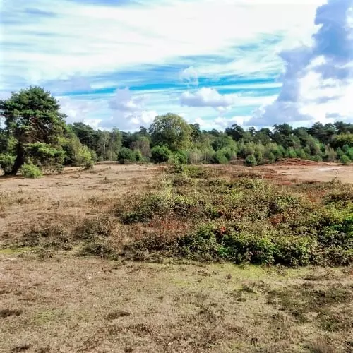
Between Leersum and Amerongen, quiet lanes wind through mixed woodlands, opening at intervals into clearings that bring light and space. Around the Leersumse Veld, heathland, drifting sands, and fens merge into a landscape that constantly shifts in color and atmosphere. Near Kwintelooijen, sandy elevations and wide vistas create a rugged setting that feels almost un-Dutch.
Along the slopes of the Utrechtse Heuvelrug, estates with beech-lined avenues and historic woodland plots have shaped the character of the area for centuries, such as around Prattenburg. Near Amerongen, this tradition of country estates comes to life, with Kasteel Amerongen as a prominent landmark set in greenery. Around Rhenen, the Grebbelinie and the Military War Cemetery add a powerful historical layer to the landscape of the Grebbeberg.
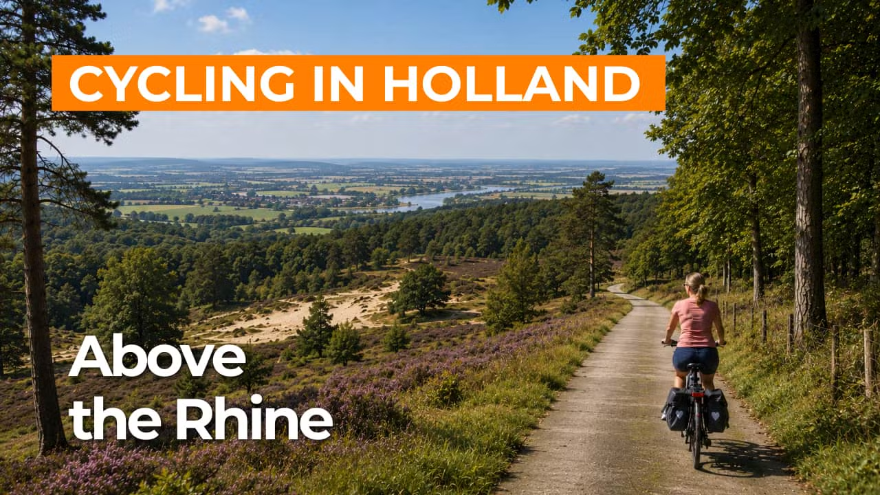
Where the higher ground descends, the river landscape of the Lower Rhine opens up, with wide, water-rich floodplains. From the Grebbeberg, the Blauwe Kamer stretches out below as a green river basin, marking a striking transition from dry, elevated terrain to low, wetland scenery that adds depth to the route. Along this waterline, the Grebbelinie gained its strategic importance, bringing nature and history closely together.
This cycling route follows the glacial ridge of the Utrechtse Heuvelrug, a varied landscape of elevated terrain and carved valleys. Near Amerongen lies the Amerongse Berg, the highest point in the province, after which the land gradually slopes towards Rhenen. At the Grebbeberg, the elevation gives way to sweeping views over the Lower Rhine and the Betuwe, providing a fitting finale to the route.
Ride along with us on this virtual bike tour
Virtually cycling through Utrechtse Heuvelrug National Park and the Grebbeberg lets you ride at ease through a varied landscape of glacial ridges, meltwater valleys, forests, and heathland. Quiet lanes lead past estates and historic country houses, with ever-changing views across sandy elevations and green woodland edges.
Towards Rhenen, the Grebbeberg adds variety with sloping forests and wide views over the Lower Rhine and its floodplains. Along the way, you encounter the history of the Grebbelinie and the Battle of the Grebbeberg, where natural scenery and heritage come together seamlessly.
Want to learn more about virtual cycling? THIS IS HOW VIRTUAL CYCLING WORKS
Route map and cycling junctions
Start and finish at cycling junction 65 on the Groene Entree in Amerongen. Because this is a circular route, you can also start at one of the other cycling junctions along the route.
Distance: 49 km
Estimated riding time: 3 hours 17 minutes
Elevation gain: 175 m
Paved roads: 78%
Unpaved / semi-paved: 22%
Ideal for: e-bikes and city bikes
Along the way: several options for a coffee break or lunch.


