
Cycling route Kromme Rijn Region and Eiland van Schalkwijk
Cycle through a centuries old natural and cultural landscape filled with castles, manor houses, forts, cherry orchards, pollard willows and river floodplains.

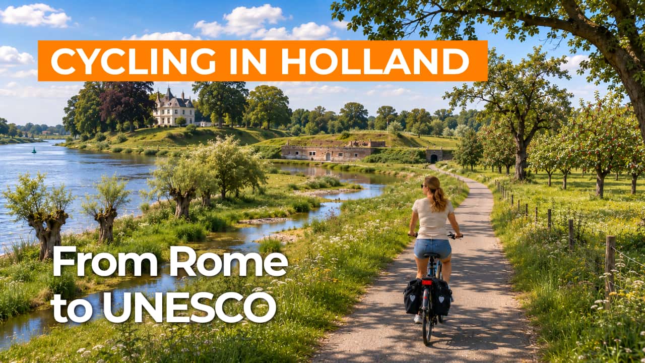
The Landscape
At the foot of the Utrechtse Heuvelrug lies the Kromme Rijn region, a transitional landscape where country estates and river clay meet and the scenery constantly changes in character. Along the Kromme Rijn, you cycle through tree lined lanes, orchards and historic village edges, with traces everywhere of a long history reaching back to Roman times.
South of Houten lies the Eiland van Schalkwijk, an open and green area naturally shaped like an island by rivers and canals. Here, forts and waterworks of the New Dutch Waterline stand close together, giving the landscape its calm and authentic character while adding a distinct historical depth to the route.
What You’ll Discover Along the Way
On the edge of Houten, you cycle through leafy woodland strips and park like greenery, where tall trees filter the light and give the route a sheltered feel. Between the open stretches, hedgerows, tree banks and old avenue plantings create variety, with occasional views across the polder landscape.
The Kromme Rijn region is rich in castles, manor houses and country estates hidden among the greenery, giving the route an elegant atmosphere. On the Eiland van Schalkwijk, forts, inundation works and defence lines shape the scenery as tangible reminders of the New Dutch Waterline.
Around Schalkwijk and Tull en ’t Waal, you cycle through wide open polders with long narrow fields, ditches and rows of pollard willows that clearly define the landscape. In season, orchards and fruit fields add extra colour to the route, with blossom in spring and cherries later in the year.
The Kromme Rijn gives the route a calm, winding character, with small bridges, green riverbanks and quiet stretches of water between reeds and willows. Closer to the Lek, the true river landscape becomes visible through dikes and floodplains, where the views open up and the wind has free rein.
Ride along with us on this virtual bike tour
Virtual cycling through the Kromme Rijn region and the Eiland van Schalkwijk lets you glide along the winding Kromme Rijn, with tree lined lanes, orchards and historic village edges giving the landscape a calm and green atmosphere. Along the way, castles, manor houses and country estates appear among the riverside greenery, creating just the right amount of variety for a relaxing ride.
Towards Schalkwijk, the polder landscape opens up and dikes, floodplains and the water of canals and rivers shape the horizon. You cycle virtually past forts and waterworks of the New Dutch Waterline, where nature and heritage blend seamlessly together.
Want to learn more about virtual cycling? THIS IS HOW VIRTUAL CYCLING WORKS
Route map and cycling junctions
Start and finish near cycling junction 33 on the Waijensedijk in Houten. Because this is a circular route, you can also start at one of the other cycling junctions along the route.
Distance: 52 km
Estimated riding time: 3 hours 27 minutes
Elevation gain: 64 m
Paved roads: 98%
Unpaved / semi-paved: 2%
Ideal for: e-bikes and city bikes
Along the way: several options for a coffee break or lunch.


