
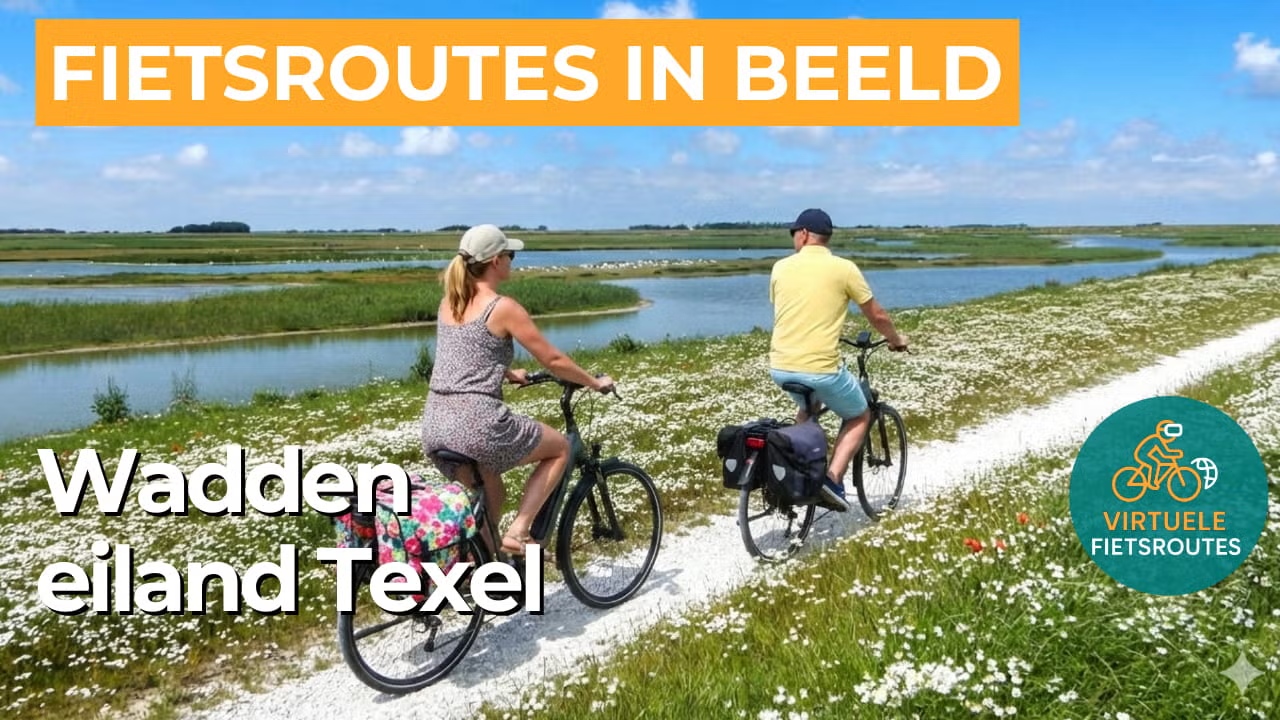
Cycling route Wadden Island Texel
Cycling through a remarkably varied island landscape with dunes and beaches, pine forests and heathland, tidal flats and salt marshes, polders and open meadows.
The Landscape
Texel is the largest Wadden Island in the Netherlands and feels like a world of its own, where you can cycle from the rugged North Sea coast to the quiet Wadden Sea dike in a single day. The landscape constantly changes in character, with wide dunes, fragrant forests, open heathlands and polders stretching towards the horizon, while the influence of the tides can be felt everywhere.
A large part of Texel lies within National Park Duinen van Texel, featuring high dunes, wide sandy beaches and sheltered dune valleys behind the coastal ridge. Along quiet cycling paths, wet dune lakes, heathland and forests alternate throughout the landscape, with blooming dune plants adding extra colour during the season. This is Texel at its finest, where land and sea meet again with every kilometre.
What You’ll Discover Along the Way
In De Dennen, you cycle through a cool pine forest where filtered light falls between the trees and the scent of resin lingers in the air. A little further on, the heathland opens up, creating wide views and the chance to spot wildlife emerging unexpectedly from the greenery. This rapid change in scenery makes this part of Texel ideal for those who want to experience the island beyond its coastline.
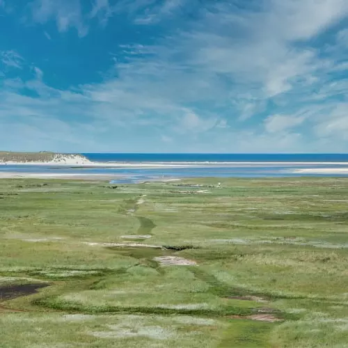
On Texel, the contrast between the rugged North Sea coast and the quiet Wadden side creates a constantly changing island landscape. Along the west coast, you cycle through rolling dunes with wide beaches, salty sea air and open views across the North Sea, while the eastern side offers peaceful rides along the Wadden Sea dike past salt marshes, tidal flats and coastal wetlands rich in birdlife. The combination of wind, water, dunes and open horizons gives the island a unique sense of space and tranquillity.
On the older parts of the island, you cycle between fields and meadows that give Texel its calm rural rhythm. Straight roads, drainage canals and long sightlines create an open and photogenic landscape, with sheep and traditional farmhouses forming familiar island scenes. Here, you experience how agriculture and nature have shaped the landscape together for generations.
Around places such as De Petten and Horsmeertjes, the landscape becomes quieter and richer in birdlife, with water lying like a mirror between reeds and grasslands. You cycle past inland lakes where birds rest and feed, making these spots perfect for a short break with a scenic view. These water rich areas provide a calm contrast to the dunes and polders along the route.
Ride along with us on this virtual bike tour
Virtual cycling on Texel lets you experience the most varied Wadden Island in one relaxing ride, from high dunes and wide beaches to pine forests and heathlands. You follow quiet cycling paths through National Park Duinen van Texel, with constantly changing views and the island’s characteristic coastal light.
After that, the landscape opens into polders, meadows and the Wadden Sea dike, where the tidal flats set the rhythm and birds fill the scenery. This way, you experience Texel in its entirety, with the constant interaction between land and sea giving you that true island feeling with every kilometre.
Want to learn more about virtual cycling? THIS IS HOW VIRTUAL CYCLING WORKS
Route map and cycling junctions
Start and finish at cycling junction 1 on the Landsdiep in Het Horntje. Because this is a circular route, you can also start at one of the other cycling junctions along the route.
Distance: 55 km
Estimated riding time: 3 hours 42 minutes
Elevation gain: 128 m
Paved roads: 99%
Unpaved / semi-paved: 1%
Ideal for: e-bikes and city bikes
Along the way: several options for a coffee break or lunch.


