
Cycling route Liemers and ’t Gelders Eiland
Cycle through a river landscape of wooded ridges, grasslands, floodplains, side channels, oxbow lakes and reed marshes.

The Landscape
Liemers and ’t Gelders Eiland together create a route rich in water, space and surprising elevation, where nature and cultural history meet at every turn. The wooded Eltenberg offers sweeping views over the Lower Rhine and the Reichswald, while in Elten the St. Vituskerk and the Drususbron stand out as remarkable landmarks with a centuries-old story.
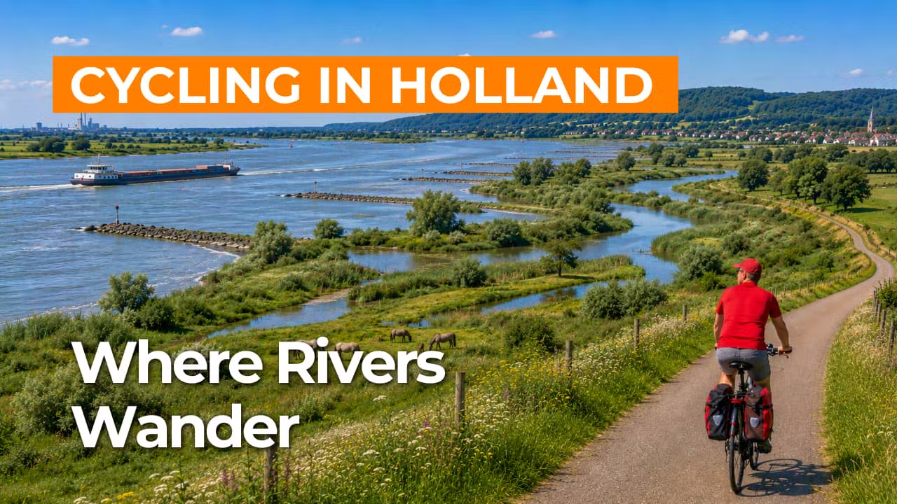
At the foot of the ridge, the dynamic Rhine floodplain of the Rijnstrangen unfolds, with reed marshes, natural levees, former riverbeds and winding channels shaping its distinctive pattern. From the dikes, you look out over rugged floodplains, flower-rich grasslands and deep oxbow lakes, while the ever-present water continually reveals the living character of this river landscape.
What You’ll Discover Along the Way
Along woodland edges, scrub and green dike lines, the route offers a varied setting of shelter and openness, creating a landscape that is enjoyable to cycle in every season. On the higher sandy stretches and along the margins of the river area, rough grasslands and heath-like vegetation appear, with wide views across the floodplains returning time and again.
Old river channels, pools and oxbow lakes lie like quiet water basins beside the dikes, adding to the area’s photogenic appeal. Reed fringes and shallow shores attract a wide variety of water birds, bringing constant life to the sheltered edges of the water. In calm conditions, each pool reflects the sky and surrounding landscape like a mirror.
The Rhine and the Waal set the rhythm here, with dikes, riverbanks and side channels giving the landscape a rugged character. You cycle past natural levees, sandbanks and willow-lined edges, as the views shift between wide and intimate. This constant contrast is what makes this part of Gelderland so distinctive and appealing.
The route feels surprisingly layered, with dike slopes, natural levees and old river ridges providing just enough elevation for scenic views, highlighted by the wooded slopes of the Eltenberg. From the higher sections, you look out over the wide riverbed and floodplains, with long lines of water and dikes stretching across the horizon. As you move between elevated dike sections and lower basin lands, the perspective constantly shifts, adding a dynamic flow to the ride.
Join our virtual bike tour and experience the journey
Virtual cycling through Liemers and ’t Gelders Eiland lets you enjoy expansive dikes, rugged floodplains and the water-rich scenery of the Rijnstrangen, with winding channels, oxbow lakes and reed marshes along the route. In the video, you experience how the river landscape constantly shifts, from open grasslands to quiet backwaters where birds and wind set the rhythm.
Along the way, the green, wooded slopes of the Eltenberg come into view, adding subtle elevation and offering beautiful vistas over the Lower Rhine. This allows you to experience from home a varied cycling route full of nature, space and distinctive river landscapes in eastern Gelderland.
Want to learn more about virtual cycling? THIS IS HOW VIRTUAL CYCLING WORKS
Route map and cycling junctions
Start and finish near cycling junction 35 on the Babborgaplein in Babberich. Because this is a circular route, you can also start at one of the other cycling junctions along the route.
Distance: 50 km
Estimated riding time: 3 hours 23 minutes
Elevation gain: 162 m
Paved roads: 92%
Unpaved / semi-paved: 8%
Ideal for: e-bikes and city bikes
Along the way: several options for a coffee break or lunch.


