
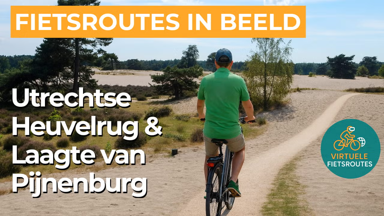
Cycling route Utrechtse Heuvelrug and Laagte van Pijnenburg
Cycling through a gently rolling landscape with dense forests, heathlands, drifting sands and stately country estates around Soest, Baarn and Bilthoven.
The Landscape
The Utrechtse Heuvelrug forms a long, gently rolling ridge in the heart of the Netherlands, created during the penultimate ice age when the land here was pushed up into a glacial ridge. Today, in Nationaal Park Utrechtse Heuvelrug, you cycle through a varied landscape of forests, heathlands and sandy clearings, with old avenues and country estates as distinctive traces of the past.
The Laagte van Pijnenburg is the low lying, wet counterpart to the higher grounds and forms the transition between the Utrechtse Heuvelrug and the Gooi region. After the last ice age, peat like landscapes developed here, later shaped by peat extraction and the creation of country estates, causing nature and culture to merge seamlessly. It is precisely this contrast between high and low landscapes that gives the route its atmosphere, tranquillity and surprising views.
What You’ll Discover Along the Way
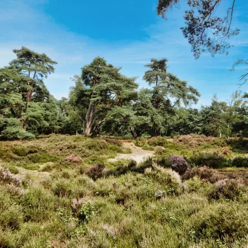
Along the route, dense forest sections alternate with open heathlands, constantly changing the light and sense of space around you. Between Soest and Leusden, you ride through extensive forest areas where heathlands and drifting sands regularly break open the green scenery. Around Soest and Baarn, sandy areas and forest edges merge together, while the wetter grounds near Pijnenburg create additional variety in the vegetation.
You cycle past a chain of country estates and manor grounds that once served as green retreats for the urban elite, with stately avenues, ancient woodland plots and monumental country houses as distinctive landmarks. Pijnenburg is one of the most recognisable estates, while nearby estates such as Staalwijk and Prins Hendriksoord, together with the nearby Paleis Soestdijk, add an elegant historical layer to the route. Further towards the Heuvelrug, the Den Treek Henschoten estate marks the transition to larger forest and heathland areas with a pronounced estate character.
The relief of the Utrechtse Heuvelrug can be felt in the short climbs and rolling stretches that give the ride a playful character. The Laagte van Pijnenburg then introduces softer, lower lying contours and wetter ground, allowing you to experience both elevation changes and landscape variety within a single route.
Ride along with us on this virtual bike tour
Virtual cycling through the Utrechtse Heuvelrug and the Laagte van Pijnenburg lets you ride through a rolling glacial ridge landscape filled with dense forests, heathlands and sandy clearings around Soest, Baarn and Bilthoven. You experience the relief up close, with quiet avenues, forest edges and constantly changing views that make this route so varied.
In the Laagte van Pijnenburg, the atmosphere shifts to a quieter, wetter landscape where the greenery becomes richer and the transitions between high and low terrain are more noticeable. Along the way, hidden country estates and manor houses pass by, bringing nature and heritage together in one virtual cycling tour.
Want to learn more about virtual cycling? THIS IS HOW VIRTUAL CYCLING WORKS
Route map and cycling junctions
Start and finish is near cycling junction 34 on the Karnemelkseweg in Lage Vuursche. Because this is a circular route, you can also start at one of the other cycling junctions along the route.
Distance: 57 km
Estimated riding time: 3 hours 48 minutes
Elevation gain: 223 m
Paved roads: 75%
Unpaved / semi-paved: 25%
Ideal for: e-bikes and city bikes
Along the way: several options for a coffee break or lunch.


