
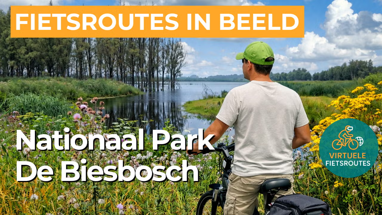
Cycling route National Park De Biesbosch
Cycling in the largest freshwater tidal area in Europe, featuring a labyrinth of rivers, islands, swamp forests and creeks.

The Landscape
The landscape of De Biesbosch National Park is a vibrant mosaic of wide rivers, narrow creeks, marshy forests, and vast reed beds. This rare freshwater tidal area still experiences the subtle rhythm of ebb and flow, giving the region its unique character. The winding shape of the Biesbosch has been shaped by centuries of flooding, land reclamation, and natural changes. After the devastating St. Elizabeth’s Flood of 1421, the area transformed into a sprawling watery wilderness. For centuries, people adapted to this challenging environment. They lived on small islands, harvested willow branches for baskets and fishing traps, and spent weeks in remote huts deep in the wetlands. Completely in tune with the rhythm of the water.
Today De Biesbosch is a vibrant and dynamic nature reserve where natural processes have plenty of room to unfold. Beavers make their home here, sea eagles breed in the area, and you can explore the watery maze of creeks and willow forests by canoe or silent boat. At the same time, human influence remains visible. Locks, dams, boardwalks, and old willow plantations tell the story of a landscape constantly changing. Thanks to high dikes, open polders, and the Delta Works, the area has become more accessible. From the cycling paths you can enjoy beautiful views of the rugged, wet nature full of water birds.
What You’ll Discover Along the Way
De Biesbosch has no sea coast, yet in places it feels like a river shoreline with wide banks, dikes and expansive views over water that rises and falls with the tide. You cycle along reed edges and willow floodplain forests, where the landscape continually opens up and then becomes sheltered again.
Around the wet heart of the park, open polders of farmland and meadows are clearly defined by canals, embankments and dikes. This transition from cultivated land to marshland nature adds variety to the route, with long sightlines and expansive skies overhead.
Between reed beds and forest edges lie quiet pools and broader water basins that catch the light and are often rich in wildlife. From the cycling path, you look out over reflective water with irregular shorelines, where nature and water management meet in a natural way.
De Biesbosch lies between major rivers and is intersected by the Nieuwe Merwede, giving you the constant feeling of cycling through a river delta. The Beneden Merwede and the Amer form the outer edges of this water labyrinth, while within it a fine network of creeks and channels defines the area’s distinctive character.
Ride along with us on this virtual bike tour
Virtual cycling through National Park De Biesbosch lets you experience the largest freshwater tidal area in Europe, with wide rivers, narrow creeks and reed beds that constantly shift in atmosphere. As you ride at a steady pace, willow floodplain forests and small islands pass by, making the route feel remarkably green and water-rich.
Along the way, you experience a true delta atmosphere, with open water beyond the dikes and views of quiet pools where birdlife defines the scene. This brings the rugged calm of this unique natural area indoors, making it ideal for a relaxed training ride with plenty of variation in the landscape.
Want to learn more about virtual cycling? THIS IS HOW VIRTUAL CYCLING WORKS
Route map and cycling junctions
Start and finish near cycling junction 8 on De Hilweg in Werkendam. Because this is a circular route, you can also start at one of the other cycling junctions along the route.
👉 Please note: From junction 8, follow the route towards junction 90. However, junction 90 is not part of the route and is used solely as a directional reference. At the Lage Zwaluwe - Werkendam ferry on Deeneplaatweg 262 in Werkendam, turn around and continue the route towards the intermediate junction + (Rondje Jantjesplaat).
Distance: 49 km
Estimated riding time: 3 hours 13 minutes
Elevation gain: 60 m
Paved roads: 100%
Ideal for: e-bikes and city bikes
Along the way: several options for a coffee break or lunch.


