
Cycling route Northeast Friesland and Wadden Sea
Cycle through a picturesque pastoral landscape of swaying reeds, flower-rich meadows, ancient terp mounds, and sweeping views across the Wadden Sea.

The Landscape
Northeast Friesland is a region where history can be read directly in the landscape. Scattered across the wide clay countryside are terp mounds that serve as ancient anchor points, artificial dwelling hills that offered protection as early as the Iron Age, long before major dikes began to structure the land. Around these terp villages, often centered on a medieval church, unfolds an open mosaic of grasslands, reed-lined edges, canals, and stately farmsteads, with a horizon that is rarely interrupted.
Toward the coast, the landscape becomes increasingly saline and expansive. On and near the sea dikes, you look out over salt marshes, tidal channels, and mudflats that constantly change shape with the ebb and flow of the tide. The Wadden Sea has been listed as a UNESCO World Heritage site since 2009 and is considered the largest tidal system in the world that functions largely undisturbed. This natural rhythm makes the area exceptionally rich in birdlife, with migratory birds resting and feeding here, and with seals finding their place on the sandbanks.
What You’ll Discover Along the Way
Around Dokkum and in the surrounding terp landscape, culture and scenery are closely intertwined, with old churches, dike villages, and characteristic farmsteads serving as landmarks along the way. This historical layering makes the route especially engaging, as you continually sense why people chose to settle here and shape the land.
On the dikes and along the coastal strip, you cycle with wide-open views toward the Wadden Sea, where sky and water continually reshape the horizon. Wind, clouds, and the tide give the route its own dynamic character, while from the top of the dike you see the landscape stretch away in a single sweeping line toward the distance.
In the polders, you ride through an open clay landscape of neatly laid-out parcels, ditches, and canals that set the rhythm of the route. Reed beds, grasslands, and long sightlines create a sense of calm and space, with ever-changing colors shaped by the seasons and the light.
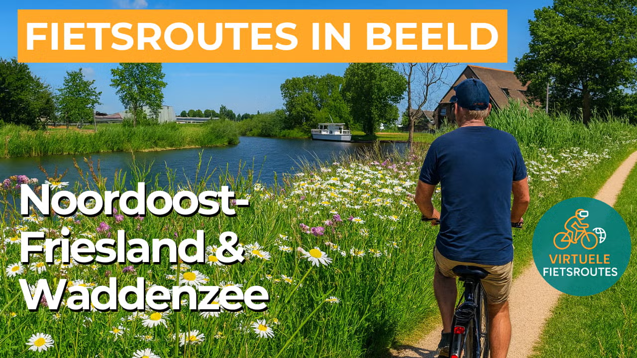
In Northeast Friesland, rivers and waterways form the natural arteries of the landscape. The Dokkumer Ee connects the city of Dokkum with the open meadowlands, giving the route a characteristic Frisian waterline. Along its banks, bridges, and towpaths, you experience how water has shaped transport, trade, and settlement here for centuries.
Ride along with us on this virtual bike tour
Virtual cycling through Northeast Friesland and the Wadden Sea lets you experience the wide terp landscape from home, with open clay fields, reed-lined edges, and long sightlines along ditches and canals. Terp villages and dikes give the landscape its rhythm, while space and wind enhance the coastal feel.
Toward the coast, the landscape becomes more saline and expansive, with big skies and a horizon that is constantly shifting. You look out over salt marshes and mudflats, where ebb and flow continually reshape the terrain and make the area remarkably rich in birdlife. An enjoyable virtual cycling route for relaxed miles on a home trainer while still capturing a true sense of the outdoors.
Want to learn more about virtual cycling? THIS IS HOW VIRTUAL CYCLING WORKS
Route map and cycling junctions
Start and finish near cycling junction 30 on the Voorstreek in Dokkum. Because this is a circular route, you can also start at one of the other cycling junctions along the route.
Distance: 56 km
Estimated riding time: 3 hours 43 minutes
Elevation gain: 37 m
Paved roads: 100%
Ideal for: e-bikes and city bikes
Along the way: several options for a coffee break or lunch.


