
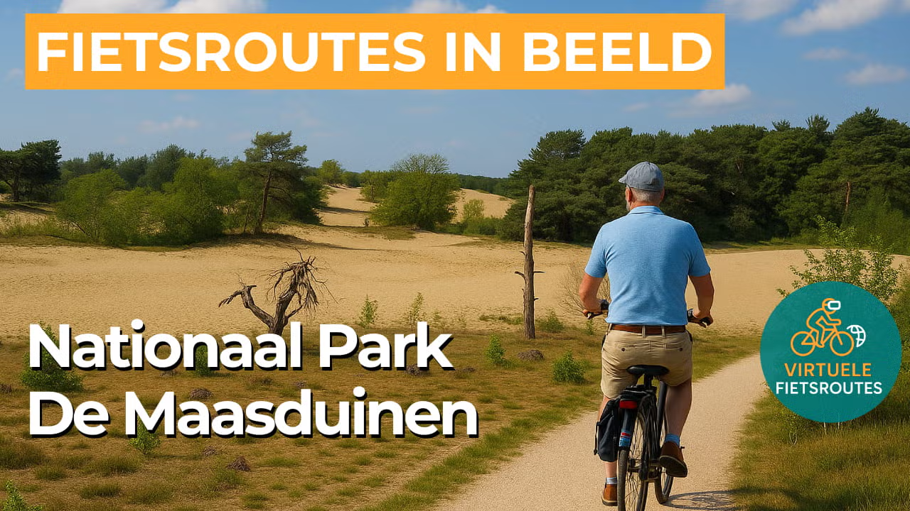
Cycling route National Park De Maasduinen
Cycling through a unique river dune landscape featuring forests, heathlands, fens, shifting sands and lakes.
The Landscape
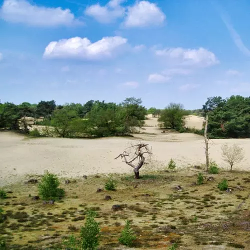
National Park De Maasduinen lies along the eastern banks of the Meuse and is renowned for the longest river dune belt in the Netherlands. Shaped by wind, water and human use, the landscape features a distinctive relief of dunes and depressions, with forests originally planted to stabilize drifting sands and protect the surrounding farmland.
Over a stretch of more than twenty kilometers, a nature reserve of over 4,500 hectares unfolds, where the landscape continuously changes in character. The route leads from sheltered forest paths to open heathland and drifting sands, with quiet fens and lakes serving as natural resting points in the green surroundings.
What You’ll Discover Along the Way
In De Maasduinen, you cycle across a gently undulating sandy plateau where coniferous and deciduous forests gradually give way to open heathland and light sandy patches. The interplay of dense greenery and open space creates ever-changing views, while dune ridges add a surprising rhythm to the route.
Along the edges of the park, the landscape opens into fields, meadows and quiet country roads with wide, far-reaching views. This transition from nature to farmland makes the route especially appealing, as it continually shifts between shelter and openness.
Between forest and heathland lie fens and lakes that give the landscape a quiet, almost mirror-like character. These water-rich areas provide cooling relief on warm days and attract a variety of birds, offering plenty to see and hear along the way.
The proximity of the Meuse is felt throughout, giving the area an open, light character with long sightlines toward the river. Small streams, wet depressions and winding waterways add variation in vegetation and atmosphere, making each section of the route feel distinct.
Ride along with us on this virtual bike tour
Virtual cycling through National Park De Maasduinen takes you across an elongated river dune landscape along the Meuse, where forested ridges, heathlands and drifting sands alternate in quick succession. The route feels constantly different thanks to subtle elevation changes and tranquil paths that guide you from sheltered pine forests to open sandy plains.
Along the way, quiet fens and lakes appear as natural pause points, adding a fresh atmosphere that brings the landscape to life. From home, you can experience one of Limburg’s most diverse natural areas, where every turn reveals a new view.
Want to learn more about virtual cycling? THIS IS HOW VIRTUAL CYCLING WORKS
Route map and cycling junctions
Start and finish near cycling junction 30 on the Bosserheide in Well. Because this is a circular route, you can also start at one of the other cycling junctions along the route.
Distance: 48 km
Estimated riding time: 3 hours 11 minutes
Elevation gain: 106 m
Paved roads: 56%
Unpaved / semi-paved: 44%
Ideal for: e-bikes and city bikes
Along the way: several options for a coffee break or lunch.


