Wadden Island Terschelling
Cycling on a beautiful island with a remarkably diverse landscape and a surprising amount of space.

The Landscape
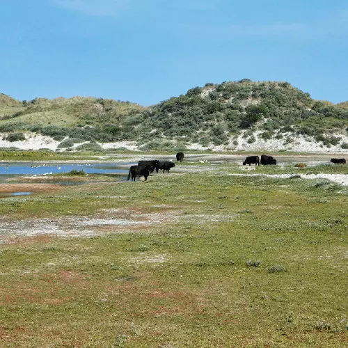
Terschelling reveals an impressive and diverse mix of landscapes, including vast mudflats, rugged beaches, damp dune valleys, mixed forests, salt marshes, polders, heathlands, and marshes. The island offers a unique concentration of diverse natural areas and biodiversity that cannot be found so closely together anywhere else in the Netherlands. No less than eighty percent of Terschelling consists of protected nature reserves.
The west side of Terschelling is characterized by wide sandy beaches and impressive dunes, while the east side has a quiet and unspoiled nature with vast salt marshes and sandbanks that become visible at low tide. The central part of the island is dominated by forests, meadows, and a series of picturesque villages that add to the island’s charm.
In the north, there is an impressive 30-kilometer stretch of gently sloping beaches, with a width of over 500 meters in some places. To the south lies the dynamic tidal landscape of the Wadden Sea, a UNESCO World Heritage site, which blends harmoniously with the island’s natural environment and is constantly changing.

Forests and Heaths

Coastal and Tidal Zone

Polders and Farmlands

Marshes and Peatlands
Cycle with us through past and present
Cycling stories of storm surges, clever forestry, and the cranberry success story
Terschelling, one of the Wadden Islands, is today a beloved destination for nature enthusiasts. This video takes you along a 45-kilometre cycling route through dunes, forests, salt marshes, and historic villages. From early settlements and clever forestry to a serendipitous cranberry success, the island unfolds a story of natural resilience and human ingenuity.
👉 Tip: Turn on the subtitles in the YouTube video to follow the full story.
Route map
Start and finish at the Haven in West-Terschelling. However, this cycle route is a round trip, so that offers the possibility to start from any desired point in the cycle route.
Until now, the island Terschelling has not a cycle route network with bike nodes. The route on this page has been determined according to the most recent cycle route planners.
- 59% of the route runs on paved roads.
- 41% of the route runs on unpaved and semi-paved paths.


