
Cycling route South Veluwe and Rhine Valley
Cycling through a primeval landscape of forested hills, expansive heathlands, marshy riverbanks, stately estates, centuries-old castles and elegant country houses.

The Landscape
Between Arnhem, Ede and Wageningen lies a typical Veluwe mosaic of forests, heathlands and sandy clearings. You ride along quiet avenues and forest paths past old oaks and beeches, while heathland and sandy expanses bring light, space and wide views.
Closer to the Rhine, the scenery shifts to river and floodplains, with wet grasslands, reed fringes and riparian woodlands that change colour with the seasons. The edge of the glacial ridge rises strikingly above the river valley here, so you continually move between higher, dry woodland and lower, water-rich landscapes.
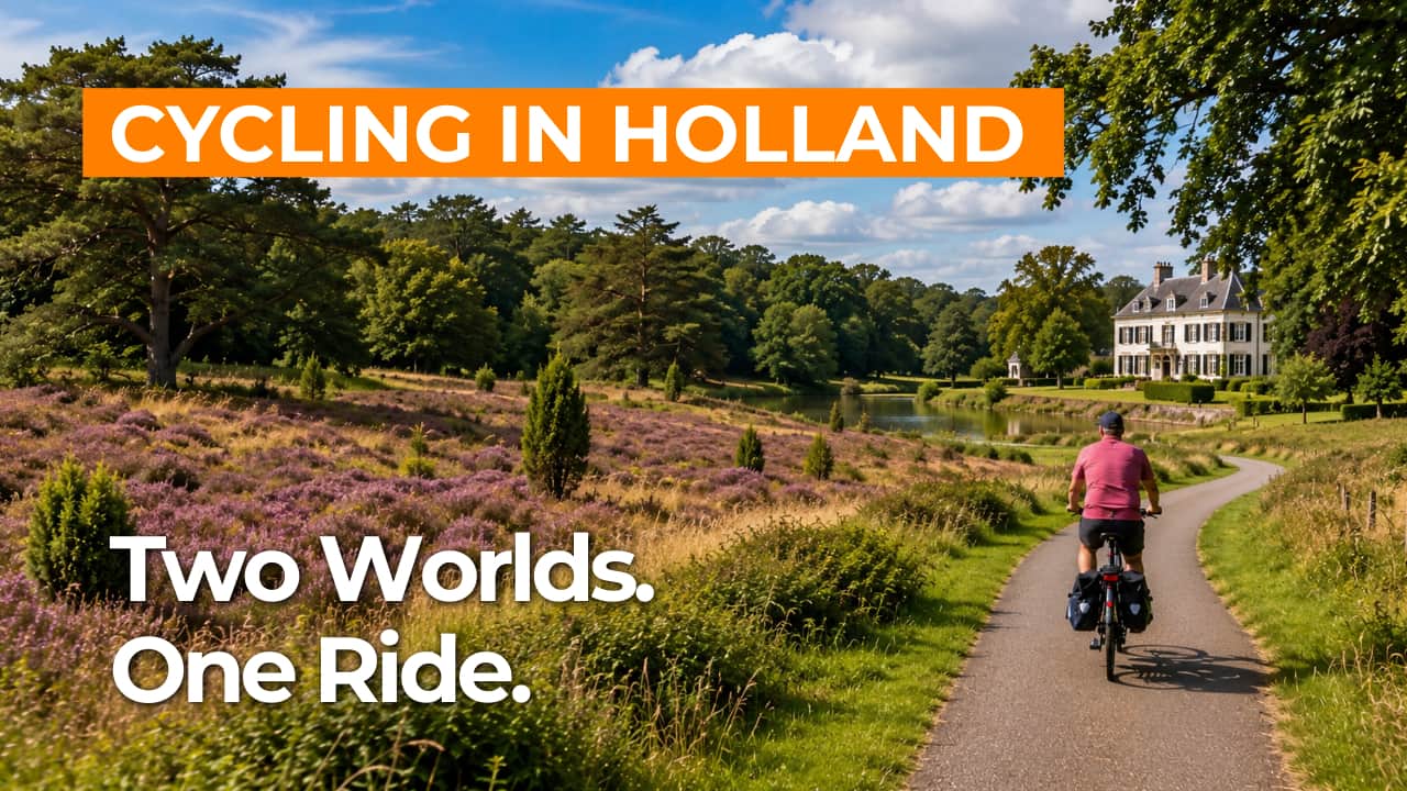
What You’ll Discover Along the Way
You cycle through continuous Veluwe forests with long, quiet avenues and leafy edges where the light filters through. As soon as you reach the heathland, the view opens up and you experience the spaciousness of the sandy plateau. This variation makes this part of the route both appealing and characteristic of the South Veluwe.
Along the route, estates and country houses give the landscape a calm, historic character, with tree-lined driveways and park woodlands. Doorwerth Castle is a standout highlight, beautifully set amid greenery on the edge of the river landscape. Along the way, you can see how nature and culture have been intertwined here for centuries.
The relief of the glacial ridge edge is noticeable in short climbs and gently undulating stretches through the forest, followed by easy descents towards the Rhine. This variation keeps the route playful and regularly opens up views over the green hills and the open river valley. As a result, every kilometre feels different, even without long or demanding climbs.
The relief of the glacial ridge edge is evident in short climbs and gently rolling stretches through the forest, followed by easy descents towards the Rhine. This variation keeps the route playful and regularly offers views over the green hills and the open river valley. As a result, every kilometre feels different, even without long or demanding climbs.
Ride along with us on this virtual bike tour
Virtually cycling through the South Veluwe and the Rhine Valley lets you experience the contrast between quiet Veluwe forests, open heathland and sandy vistas. At a calm, steady pace, you ride along long avenues and woodland edges, ideal for fully taking in the landscape.
Towards the Rhine Valley, the scenery shifts to dikes, floodplains and riparian woodlands, with an increasing sense of space, water and sky around you. The relief of the glacial ridge edge creates subtle elevation changes, keeping the virtual route dynamic without making it demanding.
Want to learn more about virtual cycling? THIS IS HOW VIRTUAL CYCLING WORKS
Route map and cycling junctions
Start and finish near cycling junction 37 on the Fonteinallee in Heelsum. Because this is a circular route, you can also start at one of the other cycling junctions along the route.
Distance: 52 km
Estimated riding time: 3 hours 26 minutes
Elevation gain: 345 m
Paved roads: 86%
Unpaved / semi-paved: 14%
Ideal for: e-bikes and city bikes
Along the way: several options for a coffee break or lunch.


