
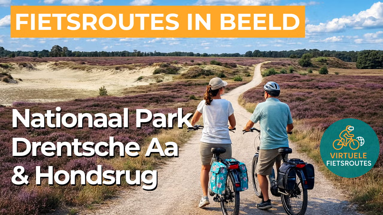
Cycling route National Park Drentsche Aa and Hondsrug
Cycle through one of the best-preserved stream valley landscapes in Western Europe, with winding streams, flower-rich hay meadows, historic es fields, and picturesque brink villages.
The Landscape
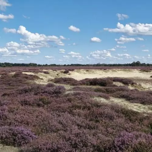
The Drentsche Aa National Park is a remarkably well-preserved esdorpen and stream valley landscape, where people and nature have shaped the scenery together for thousands of years. The Drentsche Aa still follows its natural course, and because large-scale land consolidation largely never took place here, the historic cultural landscape is instantly recognizable. You cycle past gently rounded, historic communal arable fields bordered by hedgerows, along village greens and rural tracks, and through stream valley meadows where water sets the rhythm of the landscape.
On the Hondsrug, the atmosphere changes. This elongated sandy ridge was formed during the Ice Ages by ice and meltwater and provided a dry route through a wet landscape for centuries. As a result, the area was settled early and used intensively, which is still visible in the landscape today. From megalithic tombs and burial mounds to old cart tracks and heathland reclamations, you cycle through layers of time that remain remarkably visible.
What You’ll Discover Along the Way
You cycle through wooded parts of the Hondsrug and along open heathlands where the horizon suddenly widens. The transition between higher sandy soils and heath gives the route a natural, gently undulating character and provides plenty of variety in views and atmosphere.
Along the way, you pass through characteristic villages, old farmsteads, and traditional farms that tell the story of the Drenthe esdorp landscape. Here, cultural history isn’t confined to museums but found along the roadside in village greens, hedgerows, ancient oaks, and places where settlement patterns have followed the same structure for generations.
In the lower areas, meadows and fields open out along the stream valley, with quiet roads and long sightlines. It is precisely this open space, combined with small-scale hedgerows and green edges, that makes this part of the route relaxed and enjoyable to cycle..
The Drentsche Aa and its tributaries wind through the landscape and form the natural thread of the route. The water defines the edges of hay meadows, feeds marshy patches and stream valley zones, and gives the area its calm, almost timeless character.
Ride along with us on this virtual bike tour
Virtual cycling through Drentsche Aa National Park and the Hondsrug takes you from home through one of the most beautiful landscapes of Drenthe. You ride past winding streams, hay meadows, and hedgerows, with picturesque brink villages and old farmhouses along the way that give the esdorpen landscape its distinctive character.
On the Hondsrug, the scenery shifts to forest and heathland on a gently undulating sandy ridge formed during the Ice Ages. This virtual route is ideal for training at home with a true outdoor feel and for exploring your real cycling route around the Drentsche Aa and the Hondsrug in advance.
Want to learn more about virtual cycling? THIS IS HOW VIRTUAL CYCLING WORKS
Route map and cycling junctions
Start and finish near cycling junction 61 on the Bosweg in Gasselte. Because this is a circular route, you can also start at one of the other cycling junctions along the route.
Distance: 51 km
Estimated riding time: 3 hours 27 minutes
Elevation gain: 67 m
Paved roads: 90%
Unpaved / semi-paved: 10%
Ideal for: e-bikes and city bikes
Along the way: several options for a coffee break or lunch.


