
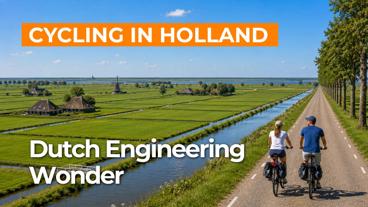
Cycling route Land of Leeghwater and UNESCO World Heritage Beemster
Cycling through a classic Dutch polder landscape, where peat meadows, open fields, straight roads, canals, dikes, traditional farmhouses, and historic buildings blend into a harmonious rural scene.
The Landscape
The Beemster is a textbook example of Dutch water management and land reclamation from the early seventeenth century. In 1612, the former lake was drained using windmills, dikes, and canals, creating a new polder with fertile clay soil more than three meters below sea level.
What makes this cycling route so special is the combination of precise planning and a living polder landscape. The characteristic grid of roads, ditches, and plots gives the Beemster a natural sense of calm and rhythm, while the Land van Leeghwater shows how reclaimed land and waterways function together as one integrated system.
Together, these polders tell the story of centuries of managing water, land, and agriculture, with long sightlines that continually draw you into the landscape. It is no coincidence that the Beemster was granted UNESCO World Heritage status: here, you can see how engineering, design, and everyday use come together to create a timeless cultural landscape.
What You’ll Discover Along the Way
In the Land van Leeghwater, you cycle along dikes, canals, and villages shaped by centuries of water engineering and polder work. In the Beemster, the traditional stolp farmhouses, historic ribbon developments, and heritage buildings stand out even more, as the strict design of the reclaimed landscape makes every element clearly legible.
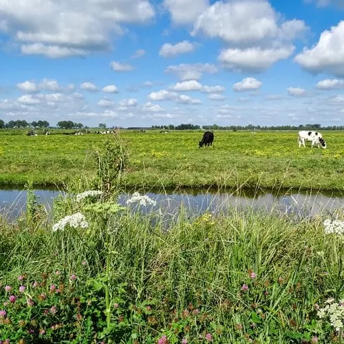
The Beemster reveals a clear checkerboard pattern of roads, ditches, and plots, effortlessly guiding cyclists through the landscape. Behind the ring dike, fields and meadows alternate in long strips, with wide-open views that are characteristic of this open polder.
Around the reclaimed polders, peat meadows and wet grasslands stretch out, where reed beds and small ditches give the landscape a softer, more natural feel. This contrast with the structured Beemster adds extra variety to the route, shifting from geometric polder lines to bird-rich, water-filled edges.
Water remains close throughout the entire route, with the ring canal, drainage channels, and broad waterways running like shimmering lines through the polder. Precisely because a lake once lay here, every dike and every waterway along the way carries an added layer of meaning.
Ride along with us on this virtual bike tour
Virtual cycling through the Land van Leeghwater and the Beemster, a UNESCO World Heritage site, takes you through a precisely designed polder landscape of straight roads, ring dikes, canals, and endless sightlines. You pass traditional stolp farmhouses and historic villages, while the story of land reclamation and water management remains visible throughout the landscape.
The Beemster lets you experience its famous grid of plots and ditches, where farmland and waterways create an almost timeless rhythm. As you cycle virtually, you take in the calm of the open polder and discover why this cultural landscape is regarded worldwide as a masterpiece of Dutch design and engineering.
Want to learn more about virtual cycling? THIS IS HOW VIRTUAL CYCLING WORKS
Route map and cycling junctions
Start and finish near cycling junction 62 on the Groeneweg in Graft. Because this is a circular route, you can also start at one of the other cycling junctions along the route.
Distance: 53 km
Estimated riding time: 3 hours 33 minutes
Elevation gain: 52 m
Paved roads: 96%
Unpaved / semi-paved: 4%
Ideal for: e-bikes and city bikes
Along the way: several options for a coffee break or lunch.


